Wizard Way
Mapping New Trails at Mount Hood Meadows

Mount Hood rising above Mt. Hood Meadows Ski Area
This summer, the Mount Hood Meadows Ski area debuted a set of new trails, nearly 8 miles that explores some of the National Forest that falls within the bounds of the ski area. As ski seasons shorten, this is part of a pivot to increase summer tourism at the lodge and sell lift tickets when there is no snow by offering the draw of riding the lifts up and exploring the meadows trails on a hike all down hill to the lodge. Of course all the trails are open to hikers, and it is really nice to have good access to some of the lovely spots in the Meadows Area that have been hard to navigate to through all the ski infrastructure. Most notably, the area above timberline and heading up the moraine above Heather Canyon is now accessible on a great trail.
These upper areas are some lovely spots that in the past I've accessed by patching together hiking trails, ski roads, and off trail. Now the segments of the Wizard Way Trail take you up to the moraine, and offer incredible views of Heather Canyon, and the Newton-Clark Moraine and Glacier. It's sort of if you mashed together the Gnarl Ridge section of the Timberline Trail with Cooper Spur and sprinkled in some Paradise Park. It's easily one of the most diverse and scenic trails on the Mount, and now that it is fully connected as an official trail, deserves to be one of the classic destination trails on the mountain.

On my last trip around the Timberline trail at the end of July, in the late afternoon just as I was leaving the Wilderness Area and entering the ski area, I encountered a hiker heading towards me (into the wilderness) who asked about trail, looking for a numbered trail. I got him turned around to go the right direction on the Timberline, and then noticed the new trail coming up the ridge and connecting to the Timberline, with a sign post and number "6" on it. New trails!
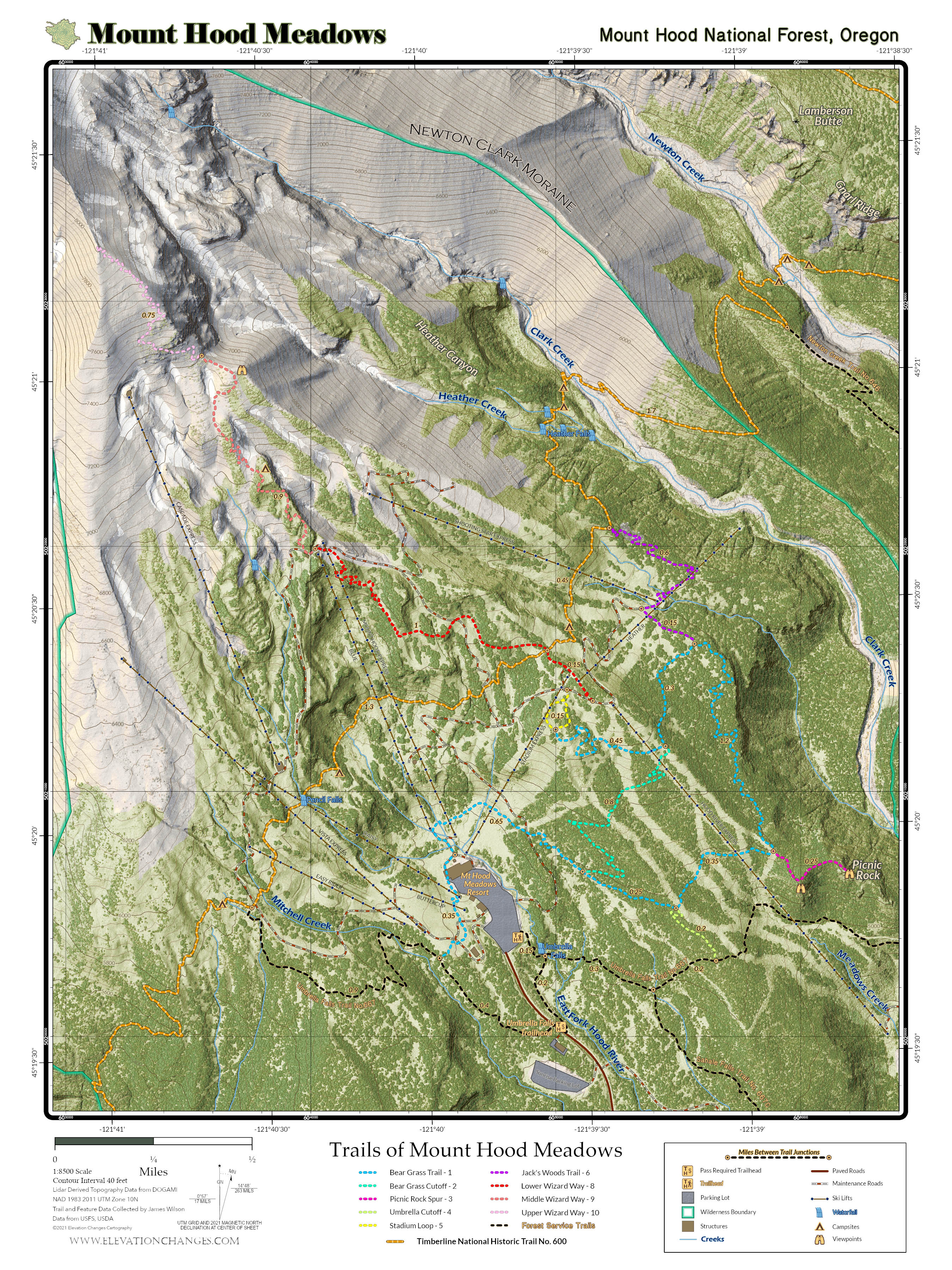
Turns out the Meadows/Forest Service has a map/pamphlet showing the new trail system, but it is somewhat of a cartographic nightmare. I decided to go out and collect tracks and make a nicer map to show off the area, and thoroughly enjoyed exploring the new set of trails. Except for the higher elevation sections of Wizard Way, the trails are built wide, graded excellently, brushed, and cleared of logs. They're really nicely built and explore through meadows, across grassy ski runs, up lovely and lonely forested ridges, and to some excellent view points. At the highest elevation, the trail system on the Official Map ends past an overlook above Heather Canyon, but the trail continues, even with a marked "10" on the post, and while it's a fainter path and slightly more windy, it is still followable up onto the moraine. There is a good sized cairn where I've chosen to end the trail on the map, but the way up the moraine continues on to some great views of the Glacier, much like trekking past tie in rock over on Copper Spur in the summer.

Top of Wizard Way

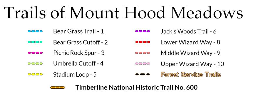
For mapping the area, I designed a map that echoes the format of the old USGS Topo Quads, and designed it at a native size of 18"x 24". The basemap is my custom map of Mount Hood's Terrain that I am developing for my Timberline Trail map project, and it is based on DOGAMI lidar data, and colorized and detailed to bring to life the geology, landforms, and vegetation of the mountain.
Exploring Mount Hood Meadows

I started my exploration at the trailhead on the road up to Mount Hood Meadows where the Umbrella Falls trail cuts across the road on its way to the falls. After visiting the falls, I continued on to the first new junction, heading north on the Umbrella Cutoff, trail "4". The junctions are marked with numbered stakes that don't include any names. Most, but not all junctions and trail starts are marked.
The Umbrella Cutoff continues north to the edge of a ski run, where it meets the Bear Grass Trail, which I followed east as it cut across ski runs and into the forest, offering glimpses of the early morning sun glowing on Mt Hood above, and south across the forest to Mt. Jeffereson where smoke from the fires in Bull of the Woods Wilderness filled the valleys.

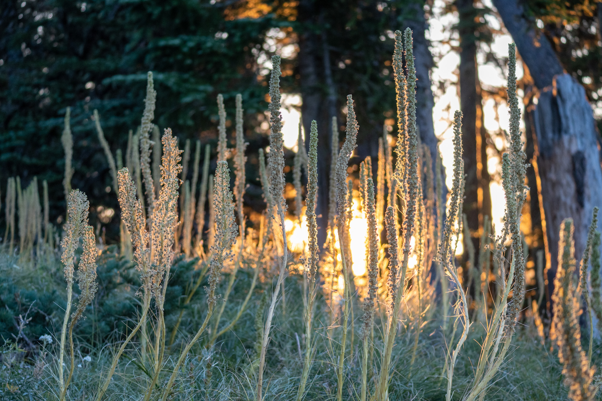
Bear Grass along the Bear Grass Trail


The Picnic Rock Spur leaves the Bear Grass Trail and travels over to emerge on a rocky outcropping looking west over the meadows, with views up Clark Creek. This is certainly one of the most photo-op worthy spots where hikers can scramble out onto the rocky ridge.


Sunrise at Picnic Rock

Wildfire smoke drifting over Mt Jefferson
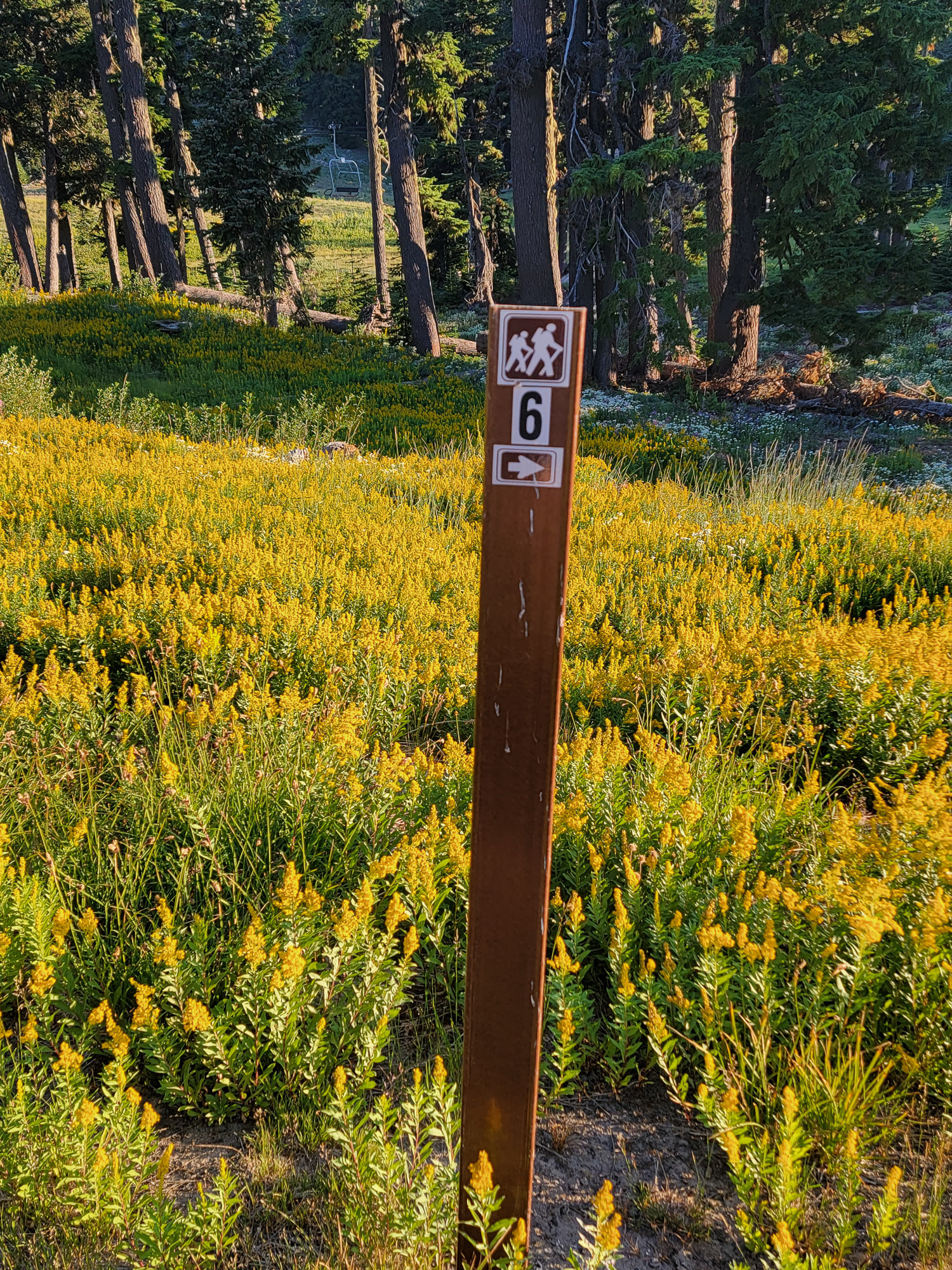
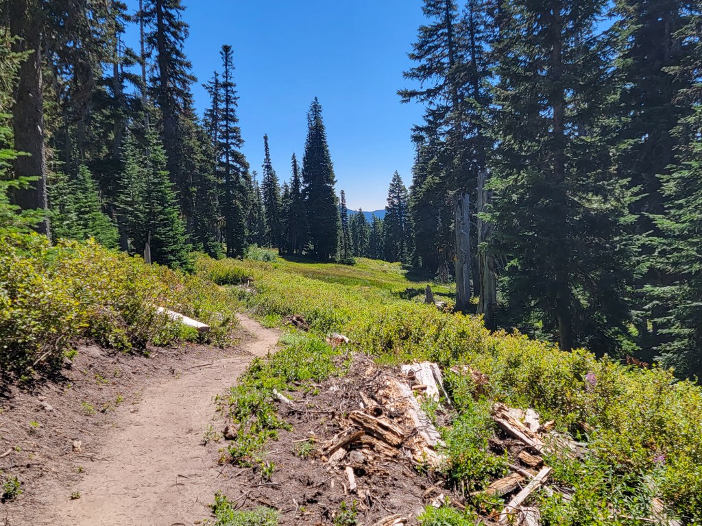
Continuing north on the Bear Grass Trail, the path climbs gradually through quiet forest, deer and elk tracks happening across the dusty trail. The trail is well designed, although it may require some water bars to control drainage in some spots once flow patterns are established when/if it ever rains. The trail through here feels quite remote and is a good exploration through some of the deeper forest. Eventually the Bear Grass Trail reaches its peak, and just before it starts to head south again, the Jack's Woods Trail splits off. This trail travels up to one of the ski area roads, and passes east on it for a short length, until just at the bottom of the Shooting Star Express it crosses one of the upper tributaries of Clark Creek and goes into the forest to climb along a ridge up to meet the Timberline Trail. Just below the Timberline Trail, it passes through a small section of forest that burned last year, but was quickly controlled.

Looking back at Picnic Rock


Along Jack's Woods Trail
Backtracking to the Bear Grass Trail, I continued south on it, passing by the Bear Grass Cutoff and switch backing up amongst meadow covered ski runs to meet the Stadium Loop, which has expansive views out over the area from below the Stadium Express Run.


Past the Stadium Loop, after taking a road either right or left uphill to connect to the Lower Wizard Way Trail, the trail climbs, weaving up through open ski runs after crossing the Timberline Trail, and eventually up a series of wonderfully graded tight switchbacks. A huge flock of Pine Siskins was foraging through here on my way up. The last bit approaches the ends of the Ski Lifts through a rock section.


Before heading up the Middle Wizard Way, the sound of water drew me east over two small rocky drainages to a creek below a section of falls. Along the way a Pika greeted me in the scree and promptly dissapeared.

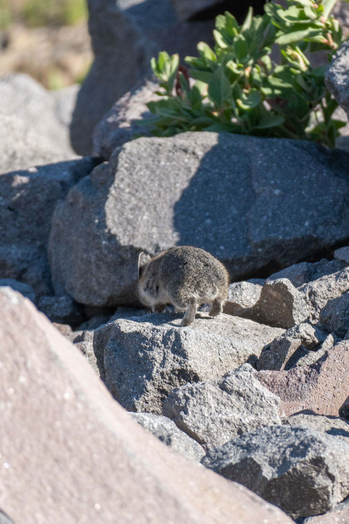
Pika!

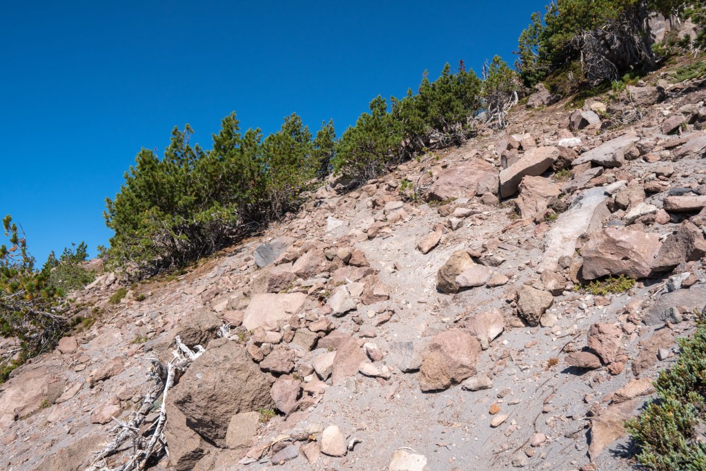
On Middle Wizard Way the trail becomes more technical, winding up amongst rockier terrain and roots and trees as it climbs on a dusty footpath. This section of high area where the timberline is growing near and the trees are stunted, windblown pines is a beautiful section with a lot of fun rock features and views. The viewpoint just off the trail near the end looks over the vast expanse of Heather Canyon, and across at the Newton Clark Moraine. It's one of the best on trail (officially now) views around Mount Hood.

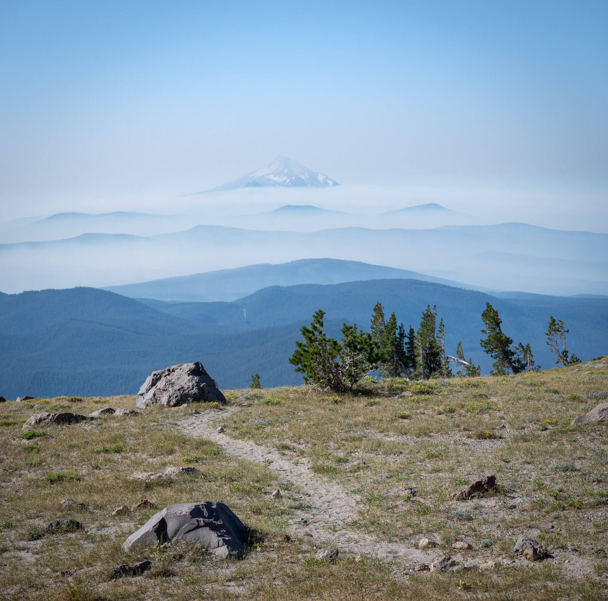
Middle Wizard Way with Mt Jefferson beyond

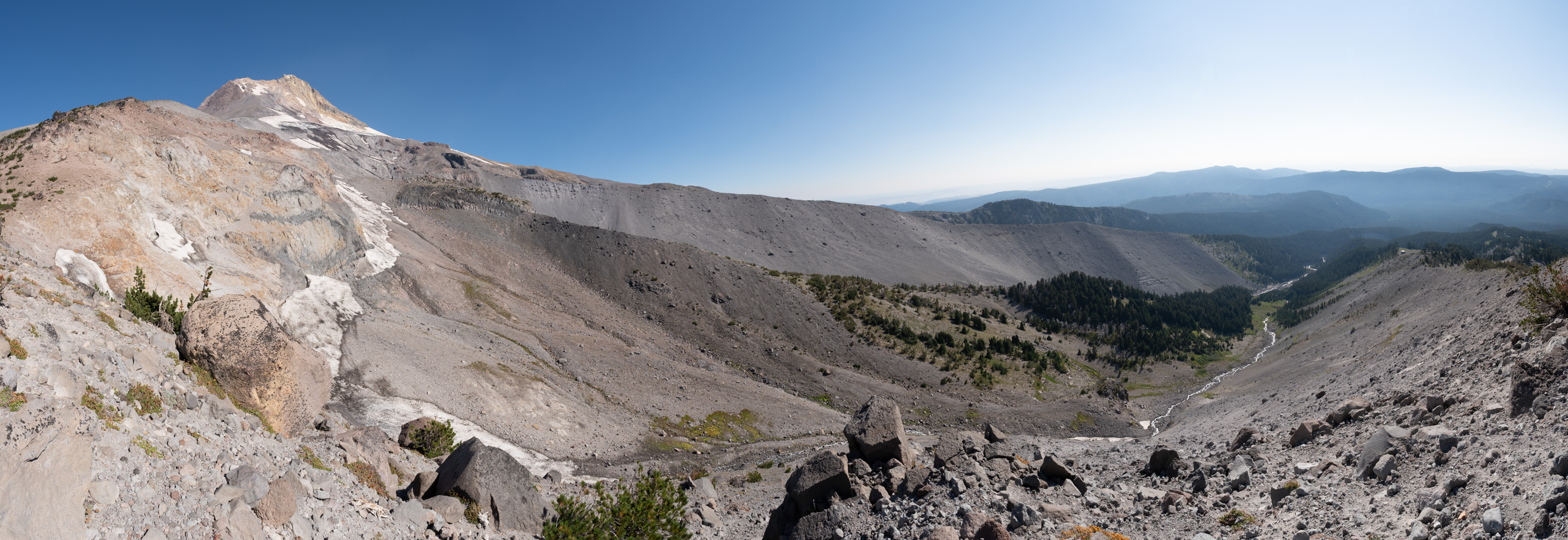
Viewpoint above Heather Canyon near the end of Middle Wizard Way
Wizard Way continues beyond the viewpoint, and although the upper section does not appear on the maps provided by the Meadows area (probably because the terrain and trail becomes steeper, dustier, rockier and slightly harder to follow), but it is still well marked and carved out. It climbs around the rocky cliff feature above Heather Canyon, rising up above the last of the trees to come onto the Moraine above Newton Clark Glacier.

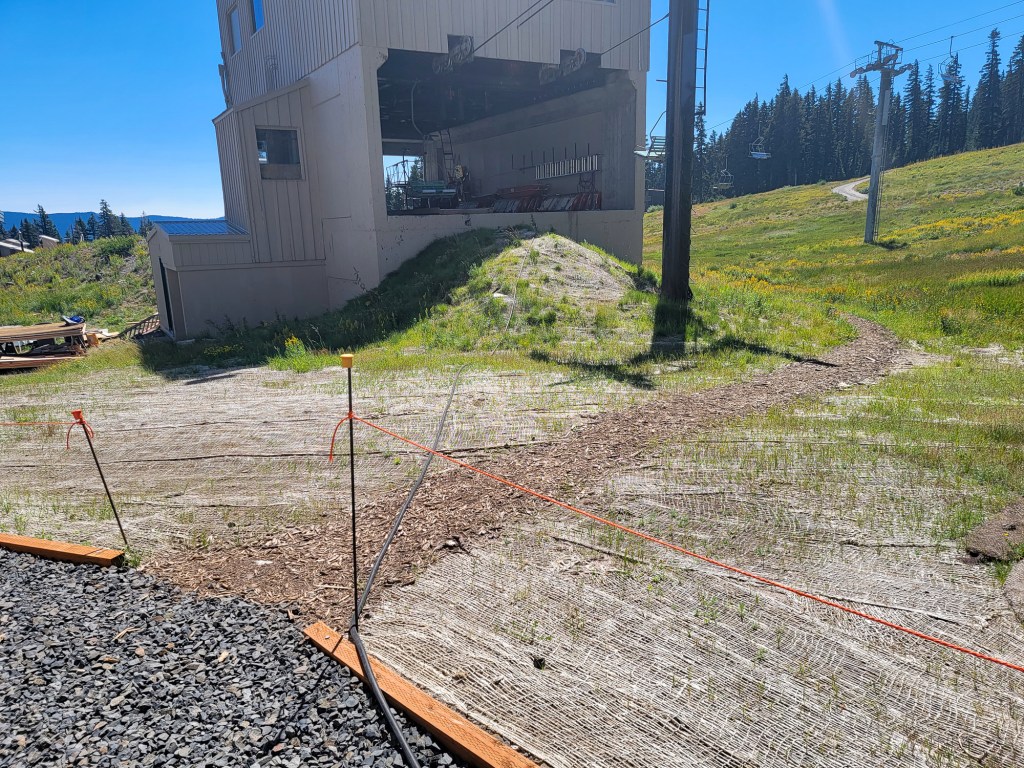
After reaching this high point for the day, just above 8000 feet, I headed all the way down, and scoped out that Bear Grass Cutoff I passed by, which cuts through the forest and a cross two ski runs to re-emerge on a section of the Bear Grass Trail. There I headed east for a quarter mile to meet the Umbrella Cutoff, then doubled back and continued west on the Bear Grass Trail to where the trail arcs through lovely meadows just above the Mt. Hood Meadows Resort. At the base of Blue and Mount Hood Express Lifts, the trail traverses down to the resort and along the west side, on some chipped paths amongst the infrastructure before cutting into the woods, and onto the brushy, overgrown Umbrella Falls Trail.
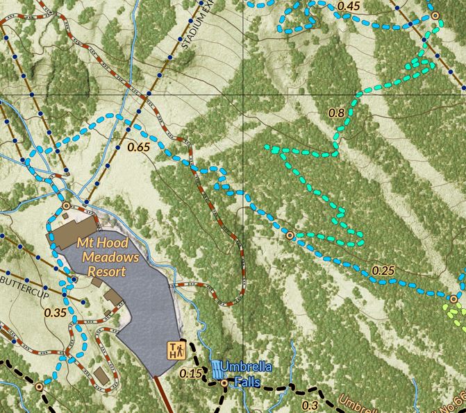
Disclamer! Hiking and entering the Forest is a risk. Hike and explore at your own risk. Use this map at your own risk. Bring the ten essentials and be safe and responsible. Practice LNT. The author and map maker holds no responsibility for your decisions or actions in hiking or exploring the areas mentioned or depicted here.


