


Avenza Maps
Catalina Island - Trans Catalina Trail - Recreation Map
Catalina Island - Trans Catalina Trail - Recreation Map
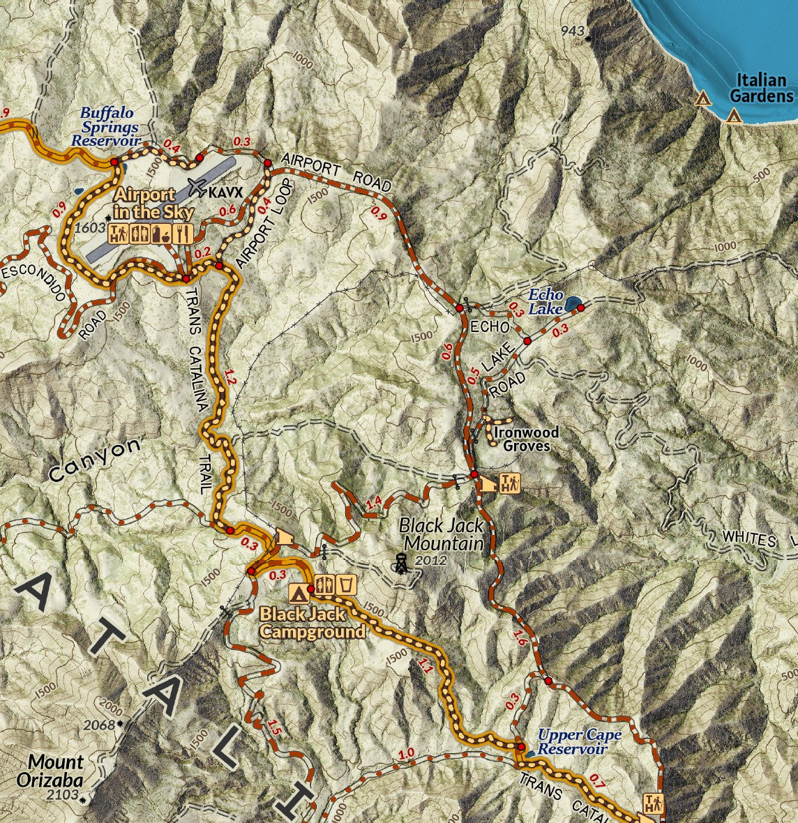
Rising up in the Pacific Ocean southwest of Los Angeles and one of California’s Channel Islands, Santa Catalina Island, commonly referred to as Catalina, is a unique destination with its rocky coastlines, grasslands, oak woodlands, and chapparal covering the island. Most of the island is owned and maintained by the Catalina Island Conservancy, which manages the landscape supporting a balance of recreational use and ecological preservation. There are over 60 endemic plants and animals unique to the island including the Catalina Island Fox, the largest predator which can be encountered when hiking and camping on the island. The foxes suffered a near catastrophic outbreak of disease imported to the island but have been making a comeback.
Ferries from the mainland shuttle visitors to the island and between the two major cities- tiny Two Harbors in the north and Avalon in the southeast which is the most developed town on the island, and the starting point for adventures. Hundreds of miles of roads are open to hiking and biking along with many dedicated hiking trails. For over 38 miles across expanse of the island, the Trans Catalina Trail spans hiking trails, roads, and (incredibly steep at times) old jeep tracks.
Elevation Changes Cartographic maps are available to purchase through Avenza Maps® for use on iPhone or Android to utilize your devices GPS and to located you on the trails or roads covered by the map while outside of cellphone service or with your phone in airplane mode, saving your battery for navigation, photos, and emergencies. Formatted and designed for use on your handheld device they include information and resources for exploring the area. Digital maps purchased through Avenza Maps® get periodic (free!) updates through versioning after significant changes to the environment such as fires, long term road closures, and new trail construction. Map files can be large as they include Elevation Changes Cartographic incredibly detailed LiDAR based terrain custom basemaps.


Collections
-

Field Maps
Field Maps for navigating while out on the trail!


