


Avenza Maps
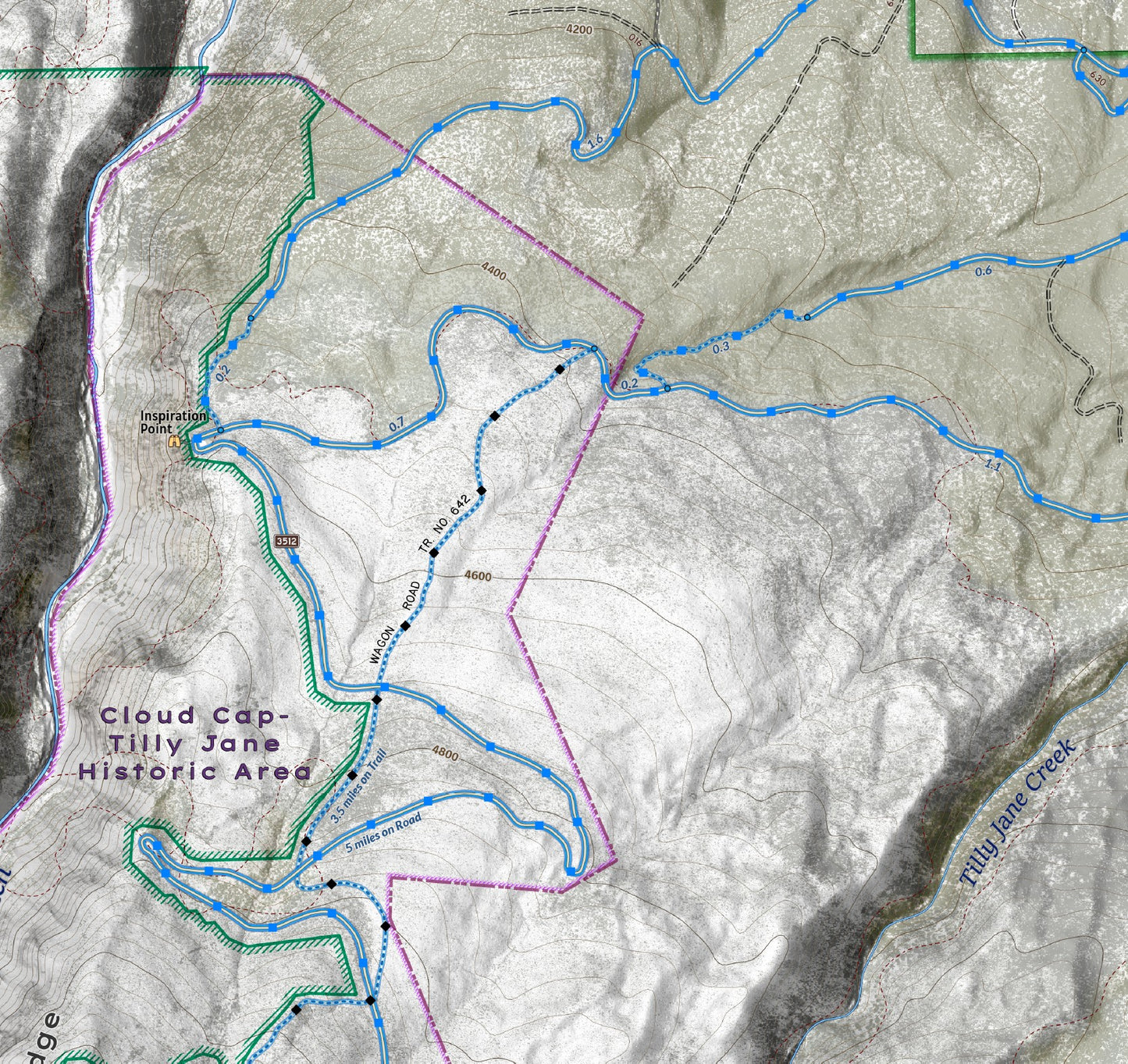
Cloud Cap - Tilly Jane Historic Area - Mount Hood Winter Recreation
Cloud Cap - Tilly Jane Historic Area - Mount Hood Winter Recreation
The Cloud Cap - Tilly Jane Historic Area was created to highlight the importance of the area in the history of the mountain and its enduring structures. Today, the non-profit organization Friends of Tilly Jane Cabins works to inspire new generations of stewards to keep remote historic spaces and landmarks open, safe, and inclusive. The road to Cloud Cap Inn and Tilly Jane Campground is gated each fall when snow closes the road, and reaching the Tilly Jane cabins is a 2.5 mile one way trek uphill, gaining around 1900 feet in elevation on the Tilly Jane Ski Trail. This map is shows the winter forest trails and road system utilized by cross country skiers and snowshoers, accessed from the Tilly Jane Sno-Park. Explore the quieter northwest corner of the mountain in winter.
Elevation Changes Cartographic maps are available to purchase through Avenza Maps® for use on iPhone or Android to utilize your devices GPS and to located you on the trails or roads covered by the map while outside of cellphone service or with your phone in airplane mode, saving your battery for navigation, photos, and emergencies. Formatted and designed for use on your handheld device they include information and resources for exploring the area. Digital maps purchased through Avenza Maps® get periodic (free!) updates through versioning after significant changes to the environment such as fires, long term road closures, and new trail construction. Map files can be large as they include Elevation Changes Cartographic incredibly detailed LiDAR based terrain custom basemaps.


Collections
-

Field Maps
Field Maps for navigating while out on the trail!


