My Store
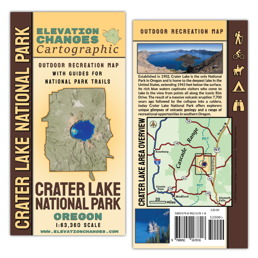
Crater Lake National Park Field Map
Crater Lake National Park Field Map
Couldn't load pickup availability
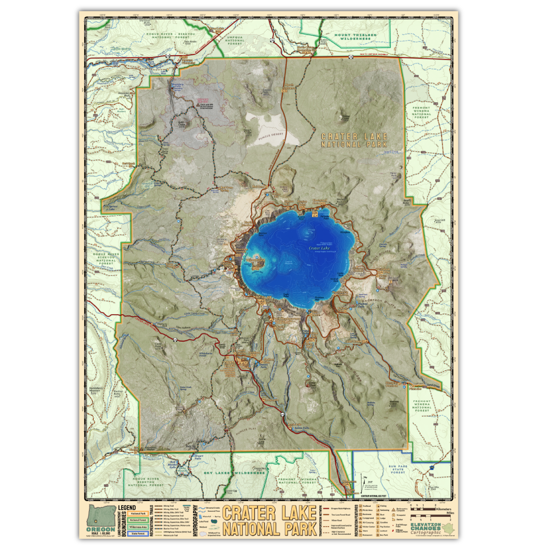
This double-sided 19.25″ x 26.75″ field map is printed on durable waterproof and tear resistant synthetic paper and folded down to a 4"x 8" cover. The map shows the area around the magnificent Crater Lake protected by Oregon's only National Park at a 1:63,360 scale where one inch equals one mile. Utilizing LiDAR digital elevation data and bathymetry, the map shows of the area's geography in stunning detail. The perfect asset for park visitors to navigate through the park and along the iconic Rim Drive and to the numerous trailheads and destinations through the park.
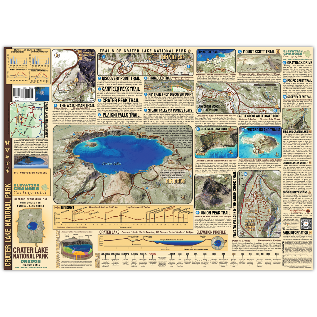
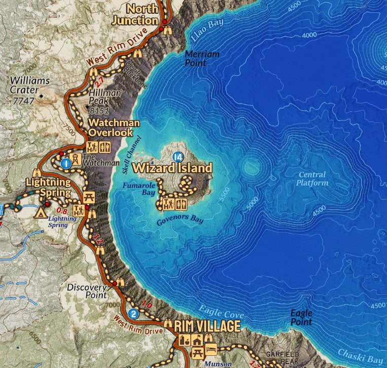
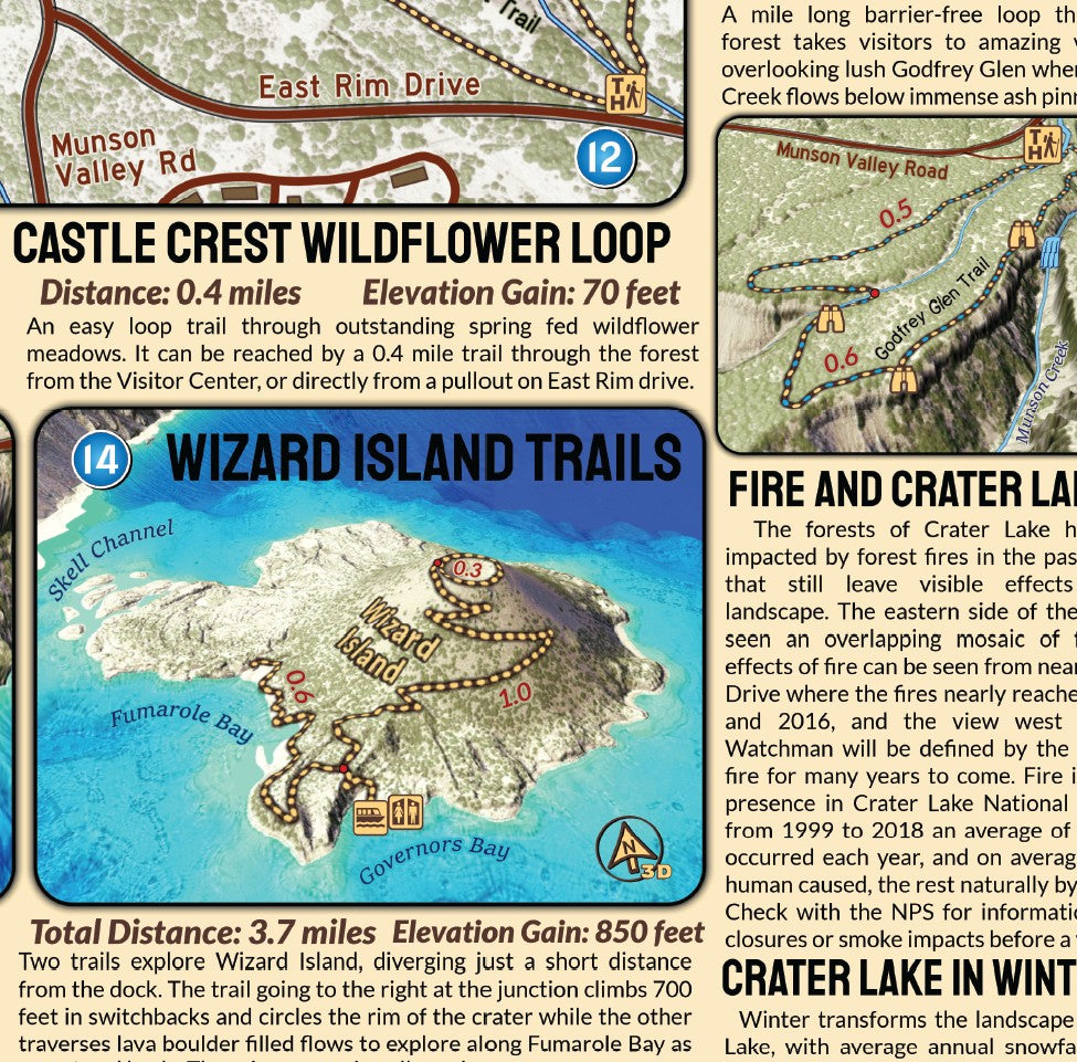
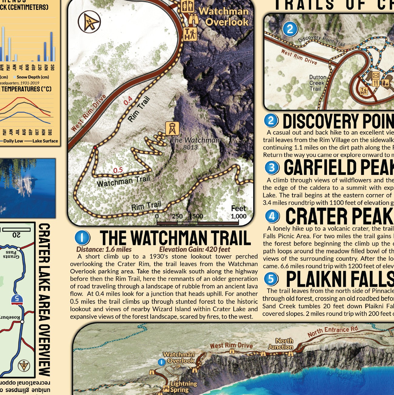
On the reverse side of the map detailed trail descriptions and mini maps, including maps in 3d perspectives highlight many of the popular trails. Learn about the geology of the caldera alongside a timeline that elaborates the history of the park.
Printed in USA
Hiking, backpacking, and exploring involve partaking in risk. This map is meant to help planning your experiences, but it is up to individuals to use best judgment and acquire the proper additional knowledge and skills to remain safe. Conditions on trails and roads can change dramatically from year to year and with weather. Unofficial Trails noted on maps are routes well established by users but may see no maintenance and may be more challenging than a maintained trail. Check all campgrounds for potential hazards, especially in inclement weather. Map users are solely responsible for their actions and decisions while using this map, assuming all the risk while referencing and utilizing this map. The map user waives any and all claim of negligence or responsibility for adverse happenings, accidents, or incidents against the map creators and Elevation Changes Cartographic LLC.
Share