


Avenza Maps
Death Valley National Park Visitor Map
Death Valley National Park Visitor Map
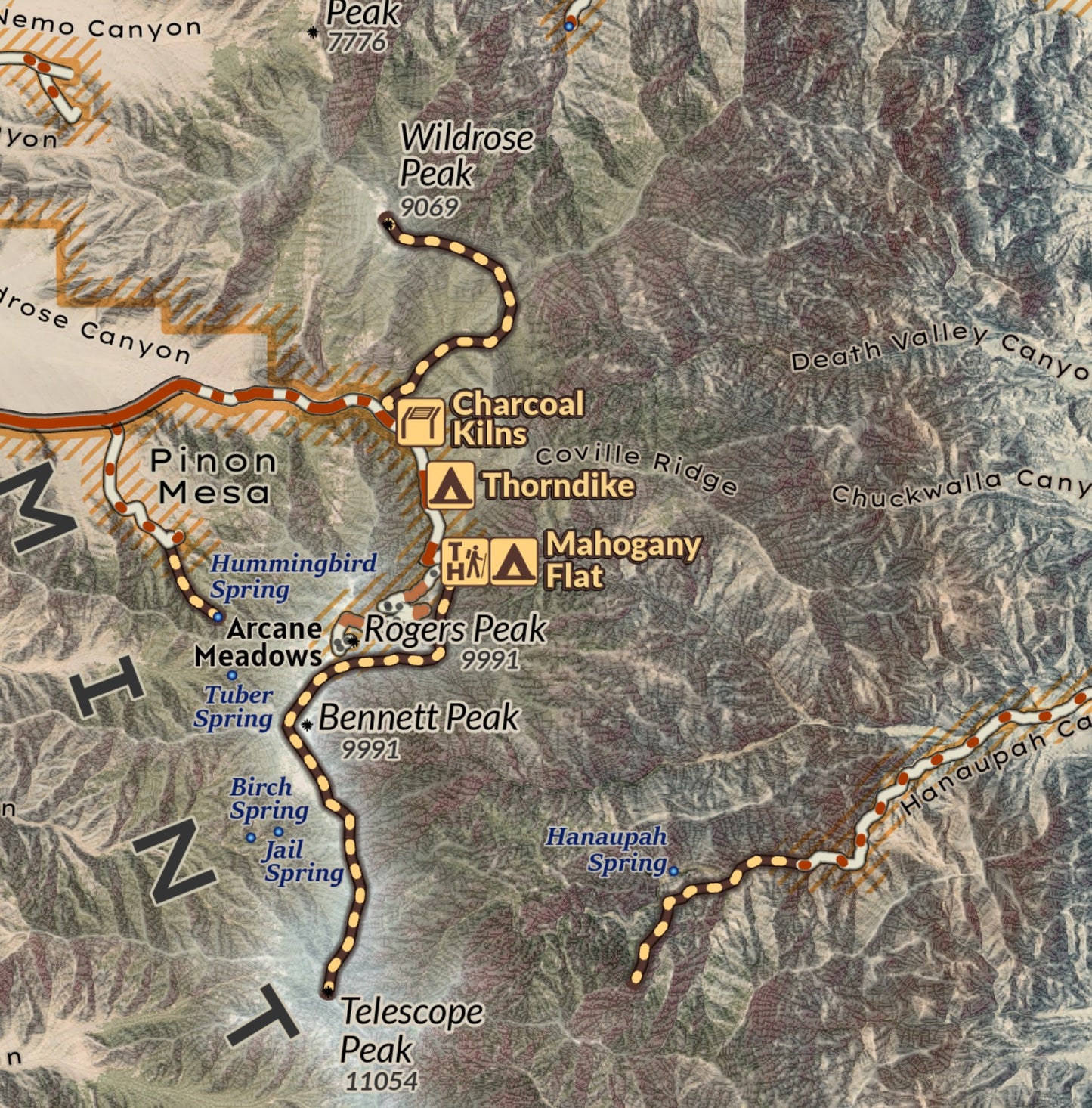
Much of Death Valley National Park is outside of cell coverage, which makes this National Park Visitor Overview and Travel Map an essential piece to have with you on trip through the vastness of the mountains and valleys. Geolocate yourself and navigate to essential recreation destinations, viewpoints, campgrounds, trailheads and more across the park and outlying area. The topography presented on the base map gives users a perspective on the landscape. Covering an immense area of California and Nevada, trails are shown, but additional references and guides when exploring the canyons and wild lands and remote roads of the National Park, as the scale of the map is designed at 1:200,000 for print.
Elevation Changes Cartographic maps are available to purchase through Avenza Maps® for use on iPhone or Android to utilize your devices GPS and to located you on the trails or roads covered by the map while outside of cellphone service or with your phone in airplane mode, saving your battery for navigation, photos, and emergencies. Formatted and designed for use on your handheld device they include information and resources for exploring the area. Digital maps purchased through Avenza Maps® get periodic (free!) updates through versioning after significant changes to the environment such as fires, long term road closures, and new trail construction. Map files can be large as they include Elevation Changes Cartographic incredibly detailed LiDAR based terrain custom basemaps.


Collections
-

Field Maps
Field Maps for navigating while out on the trail!


