


Avenza Maps
Mount Rainier National Park Visitor Map
Mount Rainier National Park Visitor Map
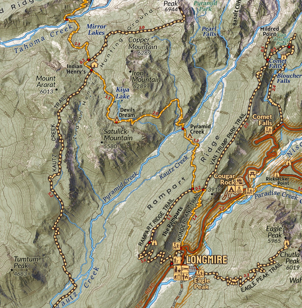
Covering all of Mount Rainier National Park, this area overview visitor map is designed at 1:50,000 scale at print and ideal for planning and navigating through the parks road systems where cell service can be intermittent or non-existent. The terrain is modeled from LiDAR elevation data to show rich details of the glacier carved landscape of Washington’s tallest peak and the most heavily glaciated peak in the lower 48. The map highlights the Wonderland Trail and locates the designated campsites along the way for those planning a trip, and the extensive trail network through the park. Explore the parks recreation sites, waterfalls, forests, and trails.
Elevation Changes Cartographic maps are available to purchase through Avenza Maps® for use on iPhone or Android to utilize your devices GPS and to located you on the trails or roads covered by the map while outside of cellphone service or with your phone in airplane mode, saving your battery for navigation, photos, and emergencies. Formatted and designed for use on your handheld device they include information and resources for exploring the area. Digital maps purchased through Avenza Maps® get periodic (free!) updates through versioning after significant changes to the environment such as fires, long term road closures, and new trail construction. Map files can be large as they include Elevation Changes Cartographic incredibly detailed LiDAR based terrain custom basemaps.


Collections
-

Field Maps
Field Maps for navigating while out on the trail!


