


Avenza Maps
Mount Hood National Forest Winter Recreation Trails and Travel
Mount Hood National Forest Winter Recreation Trails and Travel
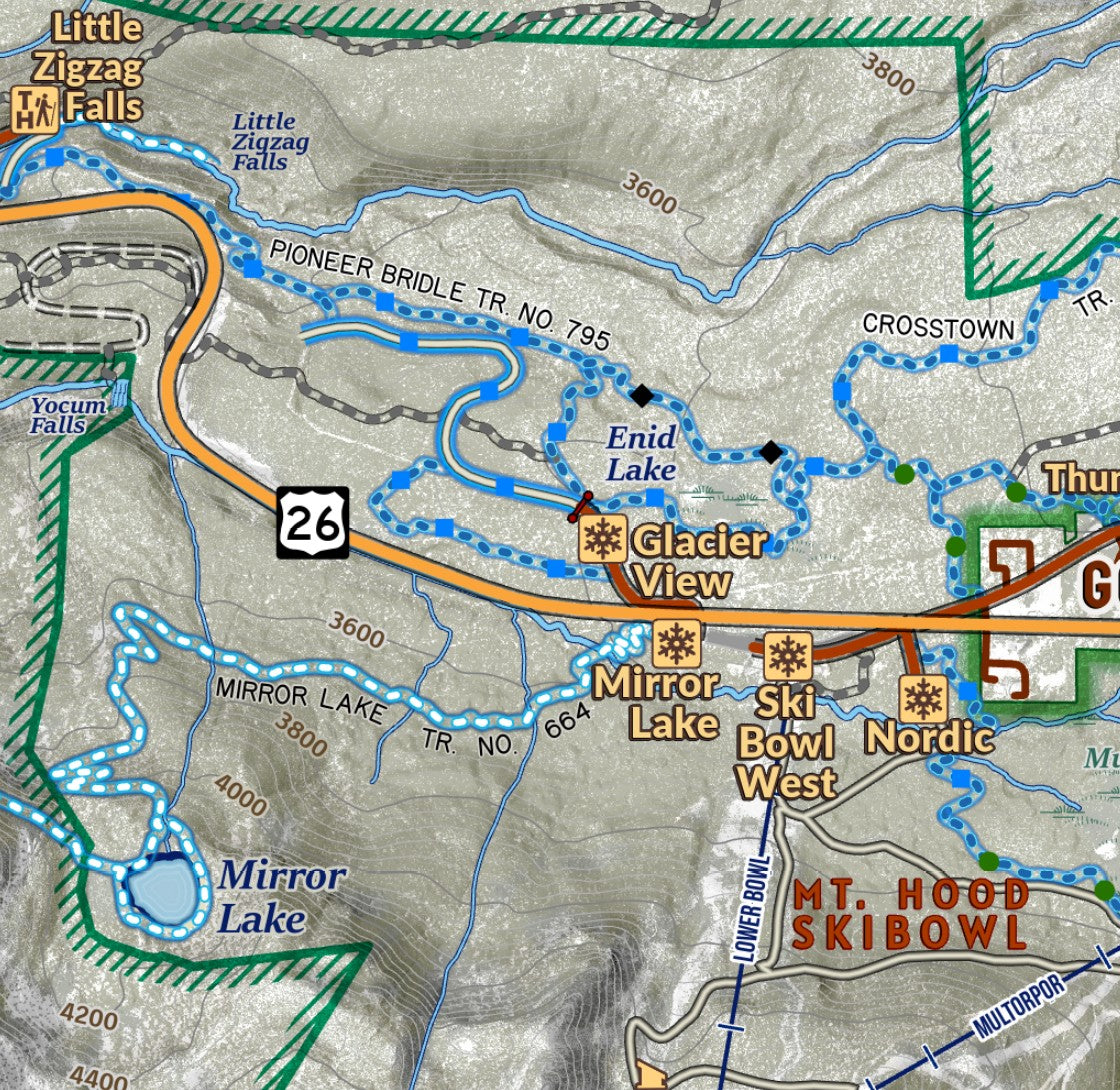
When snow blankets the Oregon Cascades, Mount Hood National Forest and area around the iconic volcano is transformed into a winter recreation wonderland. This map of the core area around Mount Hood includes the many popular Sno-Park destinations for visitors to travel to and set out on winter adventures and shows the transportation and trail system as it is encountered in winter- when gates close and forest roads become routes for cross country skiers, snowshoers and snowmobiles. Designated routes on roads and trails through the forest are identified with unique symbology, as well as indication for what routes are groomed. A Sno-Park table identifies amenities and activities at each. Plan your next sledding trip or navigate on a long cross country ski route! Additional ECC Winter Maps present key areas such as Pocket Creek and Government Camp with a greater scale.
Elevation Changes Cartographic maps are available to purchase through Avenza Maps® for use on iPhone or Android to utilize your devices GPS and to located you on the trails or roads covered by the map while outside of cellphone service or with your phone in airplane mode, saving your battery for navigation, photos, and emergencies. Formatted and designed for use on your handheld device they include information and resources for exploring the area. Digital maps purchased through Avenza Maps® get periodic (free!) updates through versioning after significant changes to the environment such as fires, long term road closures, and new trail construction. Map files can be large as they include Elevation Changes Cartographic incredibly detailed LiDAR based terrain custom basemaps.


Collections
-

Field Maps
Field Maps for navigating while out on the trail!


