


Avenza Maps
Smith Rock State Park Climbing and Hiking Map
Smith Rock State Park Climbing and Hiking Map
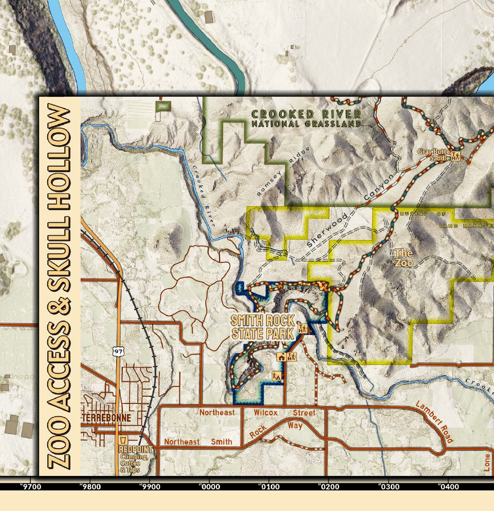
Smith Rock State Park in Central Oregon protects an outstanding outcropping of rocks where the Crooked River weaves through basalt cliffs and grassy, wildlife rich banks. The cliffs of the park are world class destination for sport climbing. This map highlights many of the climbing areas, user trails and features as they are known and referred to by climbers that been never assembled on a single map in such detail. So pair this with the local guidebook and head to the crags. Or explore the trails on foot, bike, or horseback!
Elevation Changes Cartographic maps are available to purchase through Avenza Maps® for use on iPhone or Android to utilize your devices GPS and to located you on the trails or roads covered by the map while outside of cellphone service or with your phone in airplane mode, saving your battery for navigation, photos, and emergencies. Formatted and designed for use on your handheld device they include information and resources for exploring the area. Digital maps purchased through Avenza Maps® get periodic (free!) updates through versioning after significant changes to the environment such as fires, long term road closures, and new trail construction. Map files can be large as they include Elevation Changes Cartographic incredibly detailed LiDAR based terrain custom basemaps.


Collections
-

Field Maps
Field Maps for navigating while out on the trail!


