My Store
Mount Saint Helens National Volcanic Monument Field Map
Mount Saint Helens National Volcanic Monument Field Map
Couldn't load pickup availability
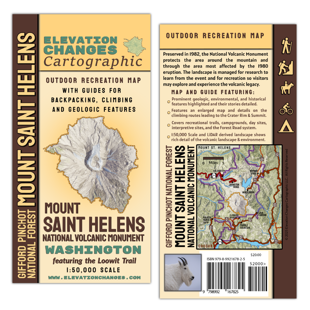
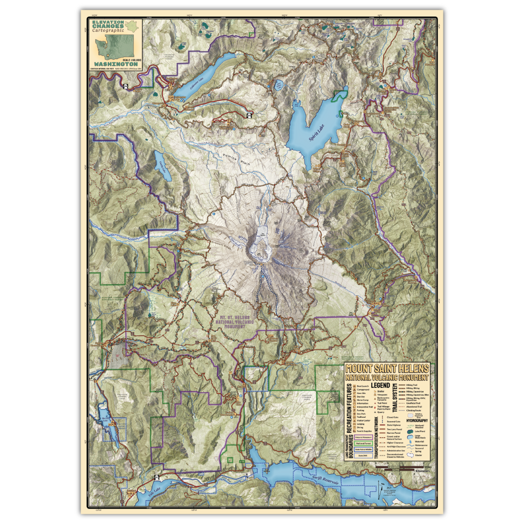
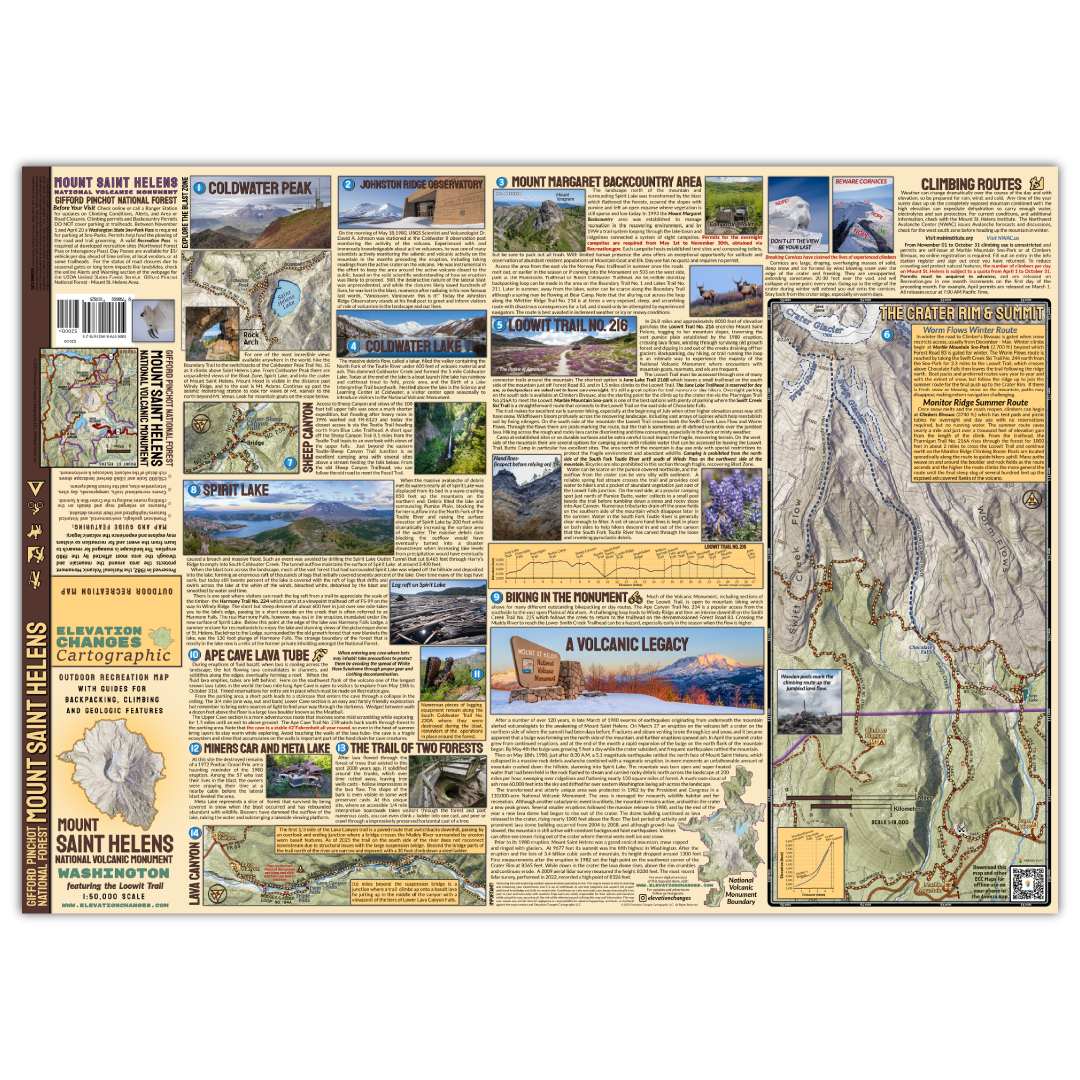
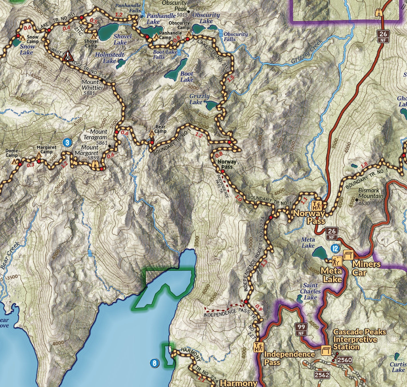
This double-sided 19.25″ x 26.75″ field map is printed on durable waterproof and tear resistant synthetic paper and folded down to a 4"x 8" cover. The map shows the area and trails around Mount Saint Helens in southwest Washington State at a 1:50,000 scale. The Mount Saint Helens National Volcanic Monument surrounding the mountain protects and and offers visitors recreational opportunities to experience the aftermath of the landscape transforming eruption of May 1980. Visitors can explore the area on foot, bicycle, or horseback and each year, thousands of visitors ascend to the Crater Rim for the views down at the young glaciers and lava dome below, and across the expanse of the blast zone to the north. The journey is experienced very differently in summer versus winter, changing from a mountaineering experience up steep (although non-technical) snow and ice to a strenuous scrambling ascent on rock and ash. Included on the backside of the map is a detailed view of the climbing routes and approach trails at 1:19,000 alongside valuable information for planning and undertaking the endeavor.
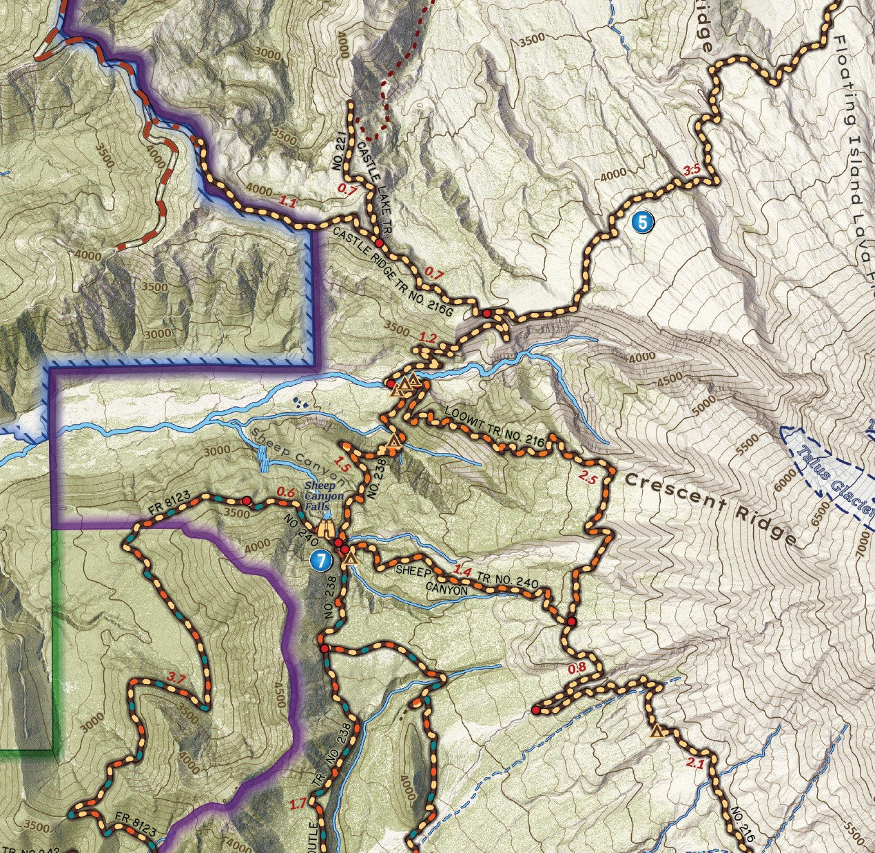
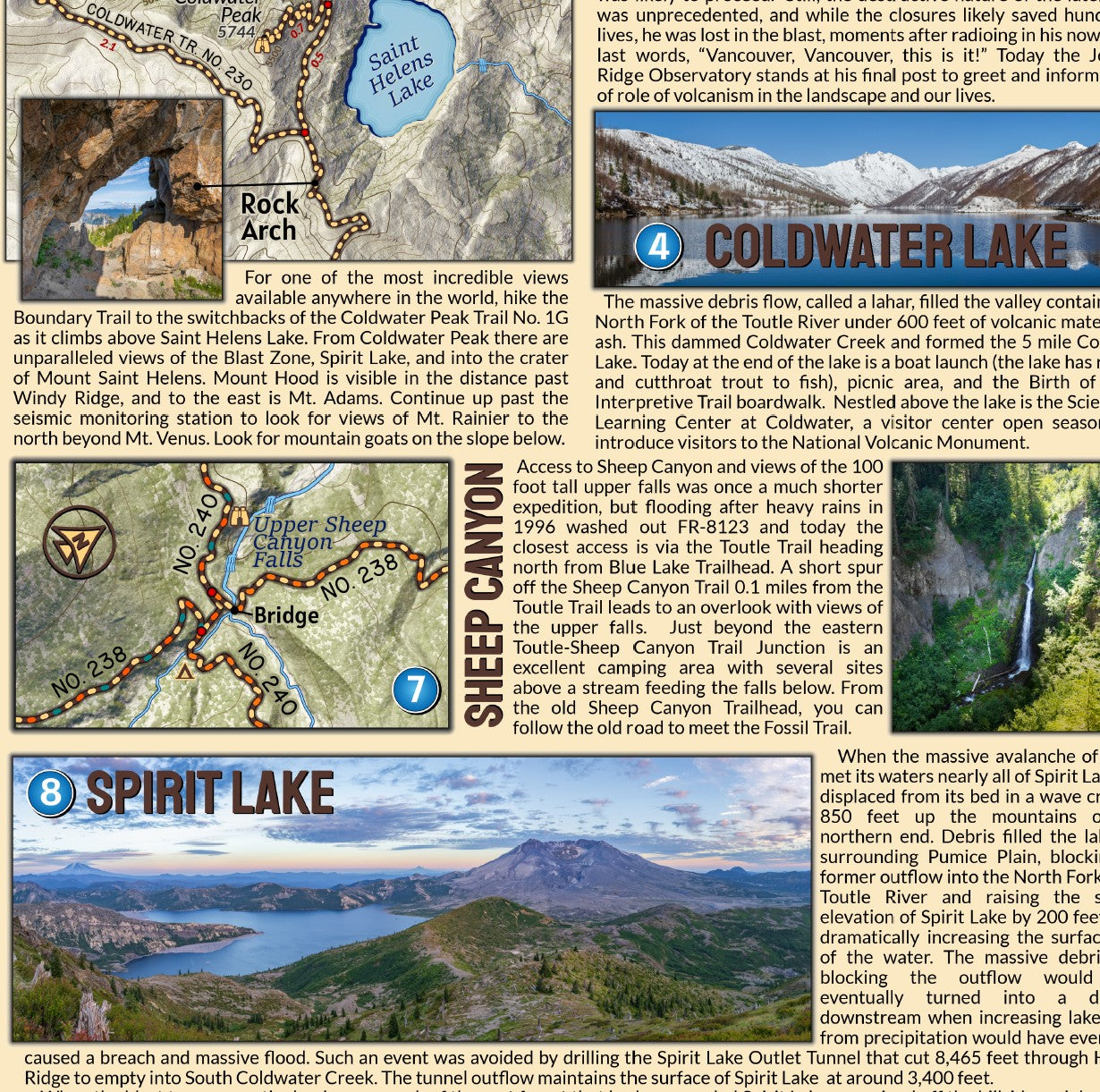
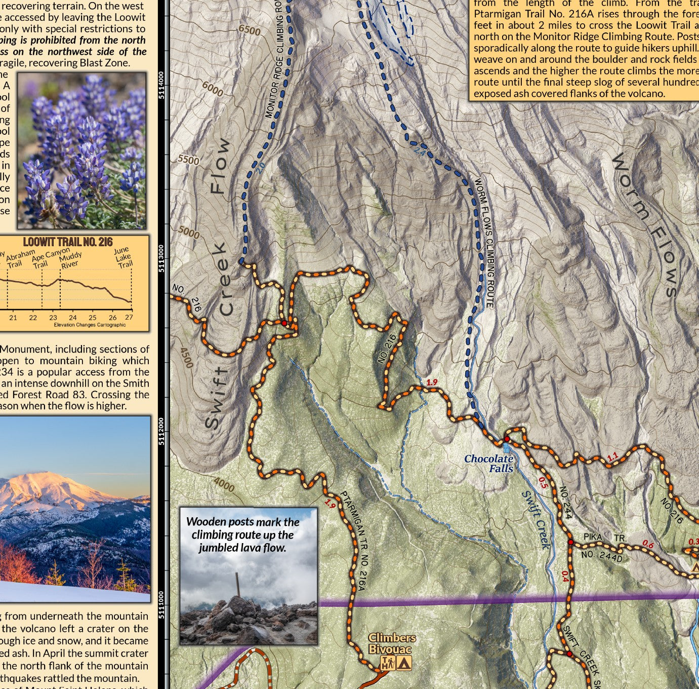
Informational content describes many of the essential spots to visit such as Ape Cave, Spirit Lake, and Coldwater Lake, as well as key details and an elevation profile for hikers or backpackers undertaking the Loowit Trail that loops around the mountain.
The creation of this map flowed from many experiences exploring what I believe to be one of the most special and dynamic landscapes available to explore. With encounters with mountain goats and herds of resident Elk to experiencing the sunrise on the Crater Rim, camping in the Mount Margaret Backcountry and exploring the Loowit Trail, the area around Mount Saint Helens is wonder. This map is designed to illustrate the volcanic landscape, provide insight into the history of the mountain and help explorers plan and undertake their expeditions.
Printed in USA
Hiking, backpacking, and exploring involve partaking in risk. This map is meant to help planning your experiences, but it is up to individuals to use best judgment and acquire the proper additional knowledge and skills to remain safe. Conditions on trails and roads can change dramatically from year to year and with weather. Unofficial Trails noted on maps are routes well established by users but may see no maintenance and may be more challenging than a maintained trail. Check all campgrounds for potential hazards, especially in inclement weather. Map users are solely responsible for their actions and decisions while using this map, assuming all the risk while referencing and utilizing this map. The map user waives any and all claim of negligence or responsibility for adverse happenings, accidents, or incidents against the map creators and Elevation Changes Cartographic LLC.
Share