


Avenza Maps
Mount Saint Helens National Volcanic Monument
Mount Saint Helens National Volcanic Monument
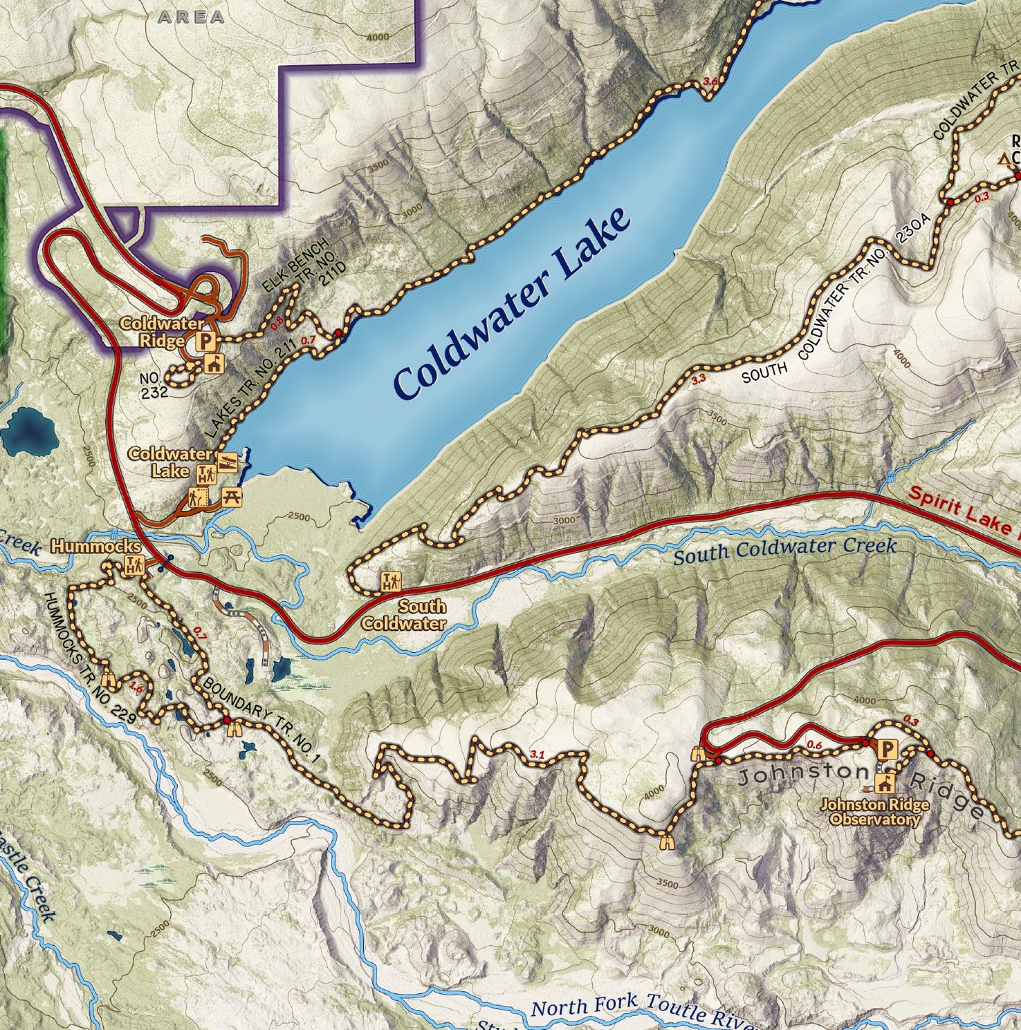
Within the Gifford Pinchot National Forest in Washington, the 110,000 acre Mount Saint Helens National Volcanic Monument protects a vast and unique landscape that bears the effects of the 1980 eruption of the mountain. The area has unrivalled views, mountain lakes, plentiful elk and mountain goats, and incredible flower displays. It is trove for recreation including hiking, biking, trail running, horseback riding, hunting, and winter sports. This map covers the area of the monument, from Swift Reservoir in the south to Iron Creek Campground in the north and includes the Mount Margaret Backcountry. An ideal map for exploring the Volcanic Monument and backpacking the Loowit Trail around the mountain, including campsite locations found while collecting data in the field.
Elevation Changes Cartographic maps are available to purchase through Avenza Maps® for use on iPhone or Android to utilize your devices GPS and to located you on the trails or roads covered by the map while outside of cellphone service or with your phone in airplane mode, saving your battery for navigation, photos, and emergencies. Formatted and designed for use on your handheld device they include information and resources for exploring the area. Digital maps purchased through Avenza Maps® get periodic (free!) updates through versioning after significant changes to the environment such as fires, long term road closures, and new trail construction. Map files can be large as they include Elevation Changes Cartographic incredibly detailed LiDAR based terrain custom basemaps.


Collections
-

Field Maps
Field Maps for navigating while out on the trail!


