


Avenza Maps
Mount Whitney Hiking and Climbing Map from Whitney Portal
Mount Whitney Hiking and Climbing Map from Whitney Portal
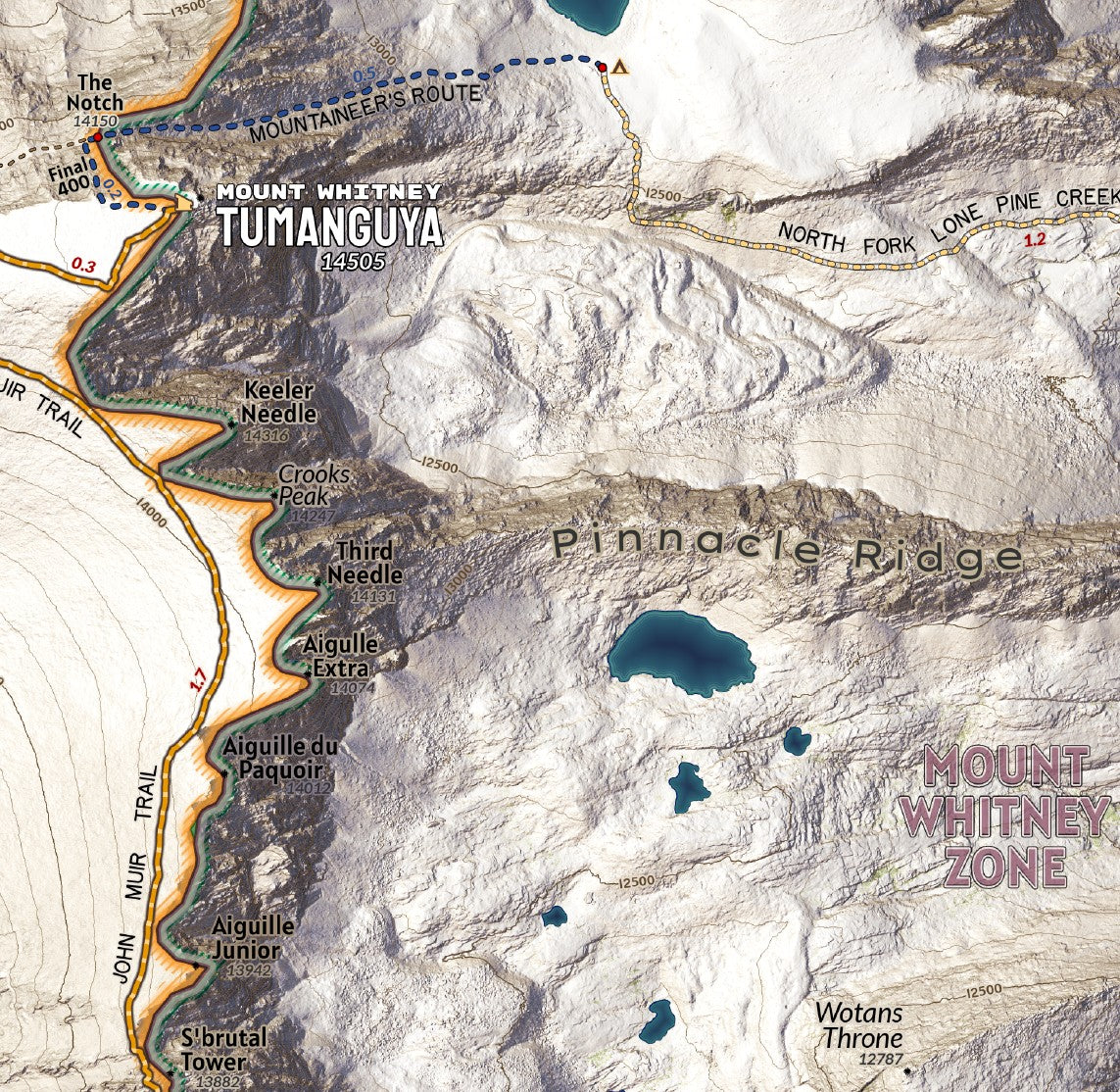
The ascent to the highest peak in the lower 48 is a classic and popular trek, but not one that should be underestimated or conducted without access to a proper map detailing the trail system, especially as the area lacks cell coverage for much of the route. This map of the Mount Whitney Zone is designed at 1:10,000 scale to aid in navigation and identifying features along the way. The terrain is modeled from LiDAR elevation data to show rich detail of the landscape and includes routes of the main hikers trail the Mount Whitney Trail and the John Muir Trail, and the advanced Mountaineers Route or the Chute to Trail Crest along the main route when the switchbacks are dangerous and icy and the route requires proper mountaineering gear for safe ascents.
Elevation Changes Cartographic maps are available to purchase through Avenza Maps® for use on iPhone or Android to utilize your devices GPS and to located you on the trails or roads covered by the map while outside of cellphone service or with your phone in airplane mode, saving your battery for navigation, photos, and emergencies. Formatted and designed for use on your handheld device they include information and resources for exploring the area. Digital maps purchased through Avenza Maps® get periodic (free!) updates through versioning after significant changes to the environment such as fires, long term road closures, and new trail construction. Map files can be large as they include Elevation Changes Cartographic incredibly detailed LiDAR based terrain custom basemaps.


Collections
-

Field Maps
Field Maps for navigating while out on the trail!


