


Avenza Maps
Paradise Trails and Camp Muir to Summit on Mount Rainier Map
Paradise Trails and Camp Muir to Summit on Mount Rainier Map
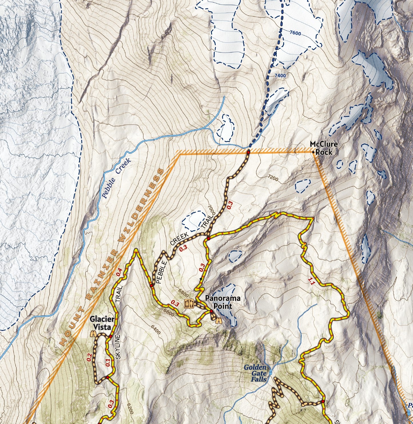
With its incredible mountain views, vibrant wildflower displays and abundant wildlife, the Paradise area on the south side of Mount Rainier is a deservedly popular hiking area. The area hosts a visitor center, lodge, and ranger station along a vast network of trails. It is the starting point for south side summit attempts of the mountain and provides access to Camp Muir above the Muir Snowfield. This map shows the trails and terrain of the area in a high degree of detail, designed at 1:10,000 scale with terrain modeled from LiDAR elevation data to show the rich detail of the landscape. The extent of the map covers the south side areas and is an ideal resource for taking along on trips to Camp Muir and summit attempts beyond.
Elevation Changes Cartographic maps are available to purchase through Avenza Maps® for use on iPhone or Android to utilize your devices GPS and to located you on the trails or roads covered by the map while outside of cellphone service or with your phone in airplane mode, saving your battery for navigation, photos, and emergencies. Formatted and designed for use on your handheld device they include information and resources for exploring the area. Digital maps purchased through Avenza Maps® get periodic (free!) updates through versioning after significant changes to the environment such as fires, long term road closures, and new trail construction. Map files can be large as they include Elevation Changes Cartographic incredibly detailed LiDAR based terrain custom basemaps.


Collections
-

Field Maps
Field Maps for navigating while out on the trail!


