


Avenza Maps
Pinnacles National Park
Pinnacles National Park
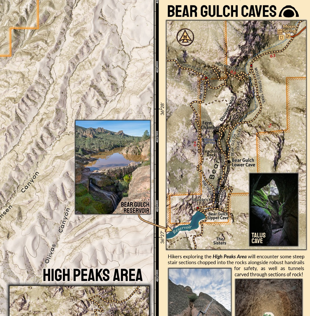
With unique systems of Talus Caves open to the public, a quiet campground, great hikes for all abilities and exceptional viewing opportunities for California Condors, Pinnacles National Park is a gem to explore. The map features the trail system and detailed inset maps for the canyons containing the Bear Gulch and Balconies Caves as well as the extraordinary High Peaks Trail area where hikers can encounter expansive views and watch Condors, Vultures, and Falcons flying below. The map is presented in detailed 1:20,000 scale with 1:5,000 scale inset maps. The detailed LiDAR based terrain background shows of the complex and intricate terrain of the park. As much of the park is not covered by cell service, downloading this map for navigation is a great idea for visitors.
Elevation Changes Cartographic maps are available to purchase through Avenza Maps® for use on iPhone or Android to utilize your devices GPS and to located you on the trails or roads covered by the map while outside of cellphone service or with your phone in airplane mode, saving your battery for navigation, photos, and emergencies. Formatted and designed for use on your handheld device they include information and resources for exploring the area. Digital maps purchased through Avenza Maps® get periodic (free!) updates through versioning after significant changes to the environment such as fires, long term road closures, and new trail construction. Map files can be large as they include Elevation Changes Cartographic incredibly detailed LiDAR based terrain custom basemaps.


Collections
-

Field Maps
Field Maps for navigating while out on the trail!


