


Avenza Maps
Teacup Nordic And Pocket Creek Winter Map
Teacup Nordic And Pocket Creek Winter Map
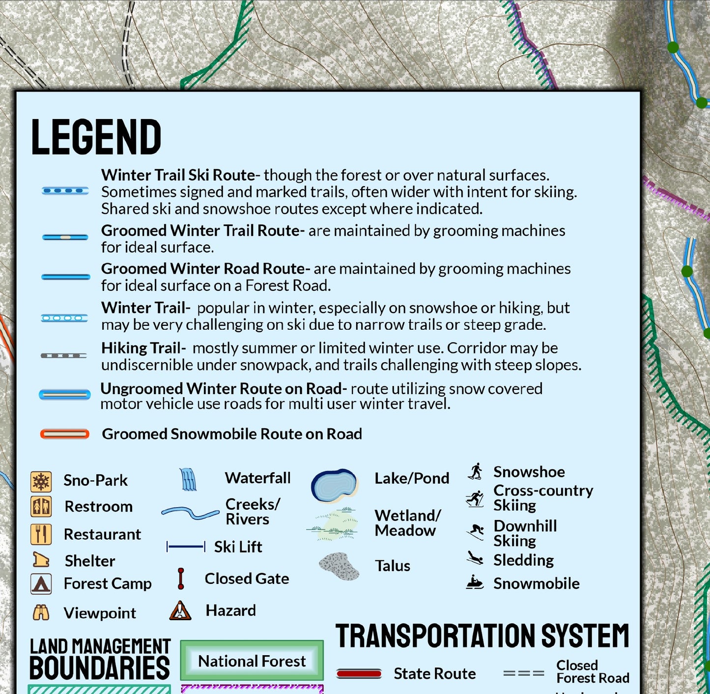
On the southeast side of Mount Hood, nearly 15 miles (24 kilometers ) of ski trails are maintained for winter use by the nonprofit Teacup Lake Nordic Club under a Ski Area Term Special Use Permit from the United States Forest Service. Since 1979 their efforts have created a diverse system of trails with a wide range of difficulty. From November to May, if conditions allow, trails are expertly groomed for both skate and classic skiing on Monday, Wednesday, Saturday, and Sunday and accessed from the Teacup Lake Sno-Park. This map covers those trails, as well as trails ski and snowshoe trails and routes accessible from Pocket Creek Sno-Park and Bennett Pass Sno-Park. Trails of Mount Hood Meadows Nordic Center are also displayed. Distances are in kilometers and relative difficulty is displayed. Trail symbology makes distinctions between groomed and un-groomed trails through forest and on roads. Guide yourself on some of the best cross country skiing terrain available.
Elevation Changes Cartographic maps are available to purchase through Avenza Maps® for use on iPhone or Android to utilize your devices GPS and to located you on the trails or roads covered by the map while outside of cellphone service or with your phone in airplane mode, saving your battery for navigation, photos, and emergencies. Formatted and designed for use on your handheld device they include information and resources for exploring the area. Digital maps purchased through Avenza Maps® get periodic (free!) updates through versioning after significant changes to the environment such as fires, long term road closures, and new trail construction. Map files can be large as they include Elevation Changes Cartographic incredibly detailed LiDAR based terrain custom basemaps.


Collections
-

Field Maps
Field Maps for navigating while out on the trail!


