


Avenza Maps
The Enchantments and Stuart Range with Icicle Canyon Adventure Map
The Enchantments and Stuart Range with Icicle Canyon Adventure Map
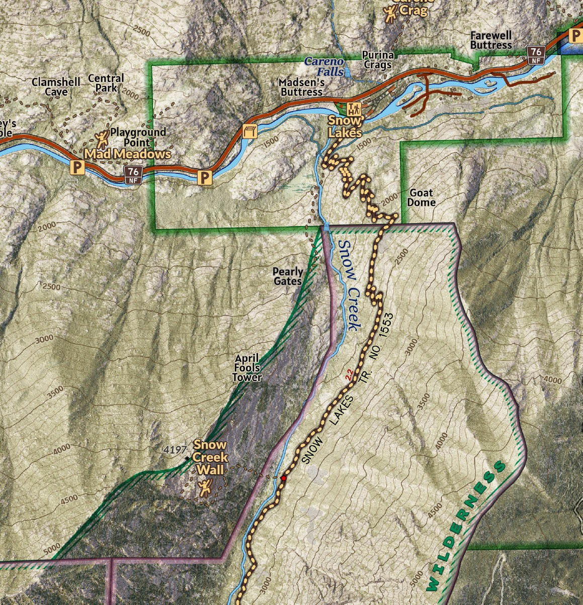
Covering a vast expanse of Alpine Lakes Wilderness outside of Leavenworth and designed at an intricate 1:20,000 print scale for highly detailed this map for navigating on explorations covers Icicle Canyon, southern Tumwater Canyon, the Stuart Range, and the Enchantment Basin. The terrain is modeled from LiDAR elevation data to show rich detail of the landscape. Whether overnighting or day hiking through the Enchantments, or backpacking along Ingalls Creek this map details the trails, lakes, campsites, and hydrography of the area. Labeled and located are many of the features and objectives for mountaineers and rock climbers, including many spires, crags, peaks, and walls and user trails, making this a great resource for climbers looking to learn the landscape and identify features and locations.
Elevation Changes Cartographic maps are available to purchase through Avenza Maps® for use on iPhone or Android to utilize your devices GPS and to located you on the trails or roads covered by the map while outside of cellphone service or with your phone in airplane mode, saving your battery for navigation, photos, and emergencies. Formatted and designed for use on your handheld device they include information and resources for exploring the area. Digital maps purchased through Avenza Maps® get periodic (free!) updates through versioning after significant changes to the environment such as fires, long term road closures, and new trail construction. Map files can be large as they include Elevation Changes Cartographic incredibly detailed LiDAR based terrain custom basemaps.


Collections
-

Field Maps
Field Maps for navigating while out on the trail!


