Elevation Changes Cartographic
Elevation Changes Cartographic maps are made with a passion for cartography and the beauty of the landscapes they depict, and the goal of enriching your experience when planning explorations and navigating on the trail. The latest remote sensing data, extensive research, and on-the-ground field work are combined to provide you with an indispensable resource for exploration. Elevation Changes field maps contain details and content highlighting the recreation opportunities of an area, as well as information about the unique cultural, historic, geologic and natural environment to deepen explorers connection and understanding of a place.
Elevation Changes Cartographic Explorations and Updates
-

Hiking the Trans Catalina Trail
Rising up in the Pacific Ocean southwest of Los Angeles and one of California’s southern Channel Islands, Santa Catalina Island, commonly referred to as Catalina, is a unique destination...
Hiking the Trans Catalina Trail
Rising up in the Pacific Ocean southwest of Los Angeles and one of California’s southern Channel Islands, Santa Catalina Island, commonly referred to as Catalina, is a unique destination...
-

Exploring Pinnacles National Park
In pursuit of creating a new detailed topographic map of Pinnacles National Park I learn about and explore the areas hiking trails, talus caves, all while watching the ever-present California...
Exploring Pinnacles National Park
In pursuit of creating a new detailed topographic map of Pinnacles National Park I learn about and explore the areas hiking trails, talus caves, all while watching the ever-present California...


Elevation Changes Field Maps
-
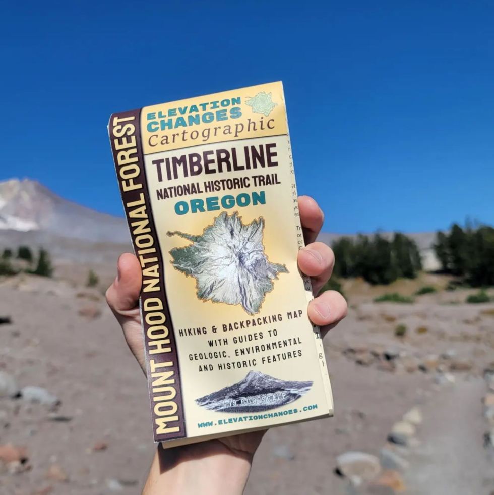
Timberline National Historic Trail Field Map
Regular price $20.00 USDRegular priceUnit price per -
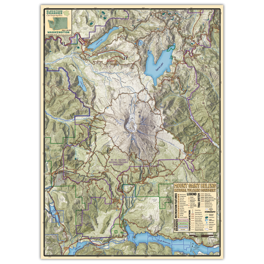
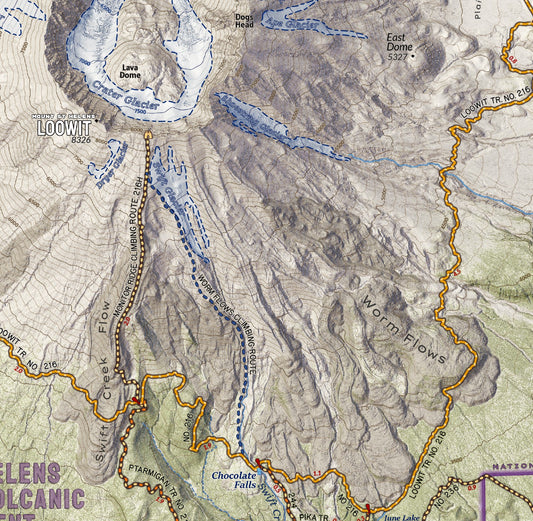
Mount Saint Helens National Volcanic Monument Field Map
Regular price $20.00 USDRegular priceUnit price per -
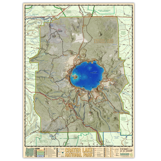
Crater Lake National Park Field Map
Regular price $20.00 USDRegular priceUnit price per -
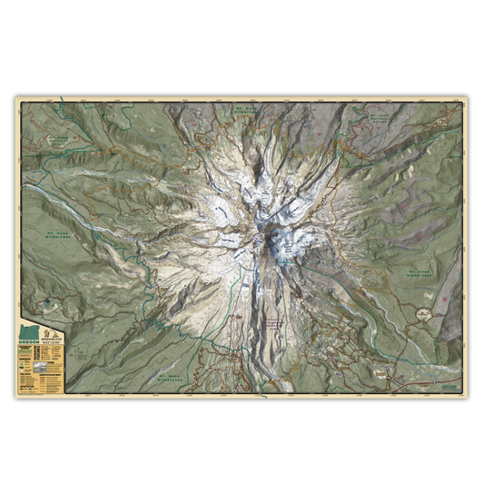
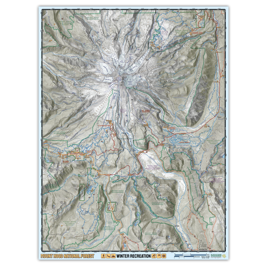
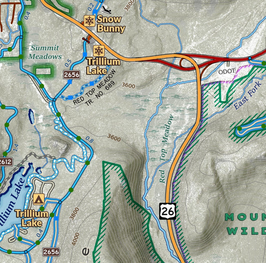
Mount Hood National Forest Winter Recreation Field Map
Regular price $20.00 USDRegular priceUnit price per


Elevation Changes Cartographic Stickers
-
Timberline Trail Elevation Profile Sticker
Regular price $4.50 USDRegular priceUnit price per -
Timberline Trail Mt. Hood Terrain Sticker
Regular price $4.00 USDRegular priceUnit price per -
Loowit Trail Mount Saint Helens Trail Profile
Regular price $3.50 USDRegular priceUnit price per -
Mount Hood Timberline Trail Sticker Sheet
Regular price $10.00 USDRegular priceUnit price per -
Mount Saint Helens Summit Elevation Profile
Regular price $2.50 USDRegular priceUnit price per -
Oregon State Terrain Sticker
Regular price $4.00 USDRegular priceUnit price per -
Loowit Trail Mount St. Helens Terrain Sticker
Regular price $4.00 USDRegular priceUnit price per -
Three Sisters Topo Sticker
Regular price $4.00 USDRegular priceUnit price per -
Mount Rainier Wonderland Trail Terrain Sticker
Regular price $4.00 USDRegular priceUnit price per -
Crater Lake National Park Terrain Sticker
Regular price $4.00 USDRegular priceUnit price per


Wall Maps!
-
Mount Hood - Timberline Trail
Regular price $25.00 USDRegular priceUnit price per -
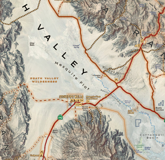
Death Valley National Park Wall Map
Regular price $35.00 USDRegular priceUnit price per -
Mount Saint Helens Wall Map
Regular price $30.00 USDRegular priceUnit price per -
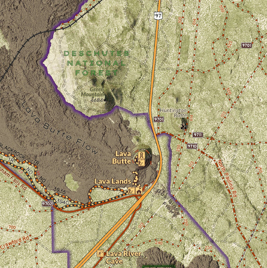
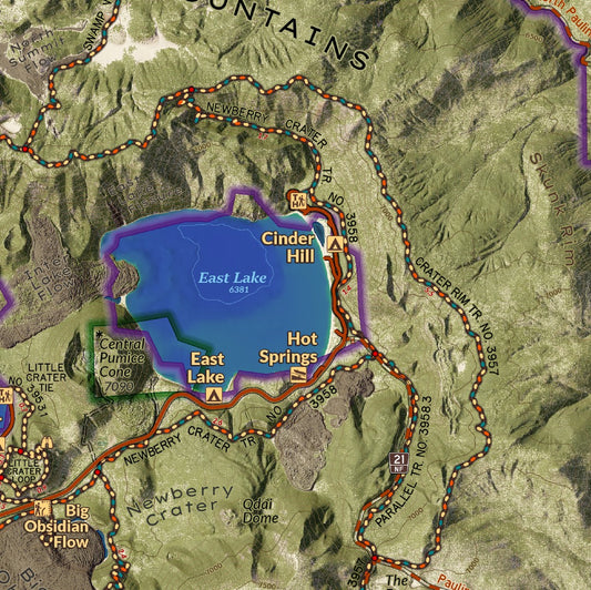
Newberry National Volcanic Monument Wall Map
Regular price $30.00 USDRegular priceUnit price per -
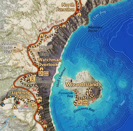
Crater Lake National Park Wall Map
Regular price $30.00 USDRegular priceUnit price per


Elevation Changes Digital Maps
-
Catalina Island - Trans Catalina Trail - Recreation Map
Vendor:Avenza MapsRegular price $4.99 USDRegular priceUnit price per -
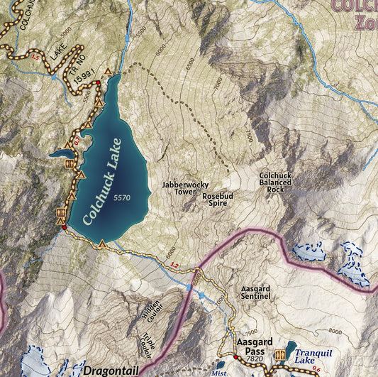
The Enchantments and Stuart Range with Icicle Canyon Adventure Map
Vendor:Avenza MapsRegular price $9.99 USDRegular priceUnit price per -
Mount Whitney Hiking and Climbing Map from Whitney Portal
Vendor:Avenza MapsRegular price $4.99 USDRegular priceUnit price per -
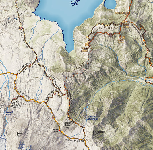
Mount Saint Helens National Volcanic Monument
Vendor:Avenza MapsRegular price $9.99 USDRegular priceUnit price per -
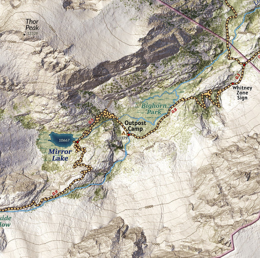
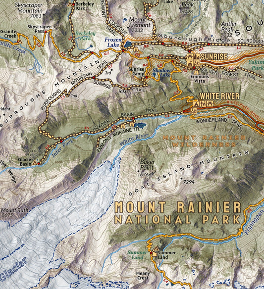
Mount Rainier National Park Visitor Map
Vendor:Avenza MapsRegular price $9.99 USDRegular priceUnit price per -
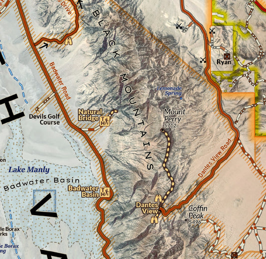
Death Valley National Park Visitor Map
Vendor:Avenza MapsRegular price $9.99 USDRegular priceUnit price per -
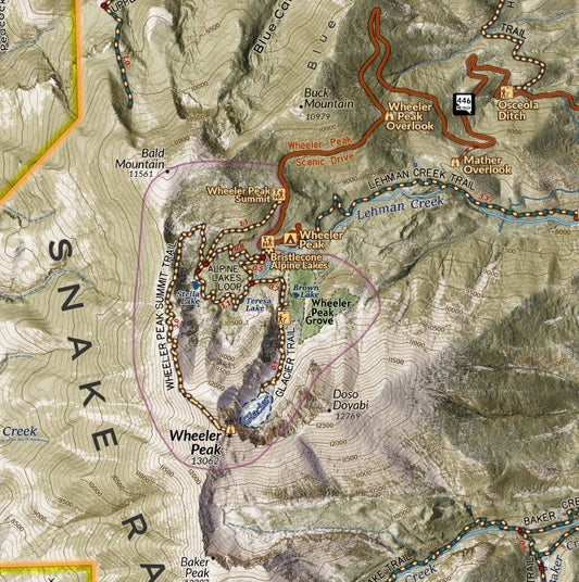
Great Basin National Park Visitor Map
Vendor:Avenza MapsRegular price $9.99 USDRegular priceUnit price per -
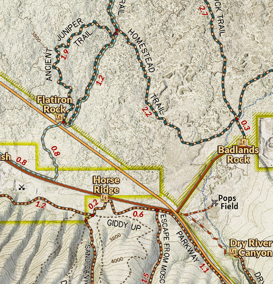
Oregon Badlands Wilderness and Horse Ridge
Vendor:Avenza MapsRegular price $4.99 USDRegular priceUnit price per -
Smith Rock State Park Climbing and Hiking Map
Vendor:Avenza MapsRegular price $4.99 USDRegular priceUnit price per -
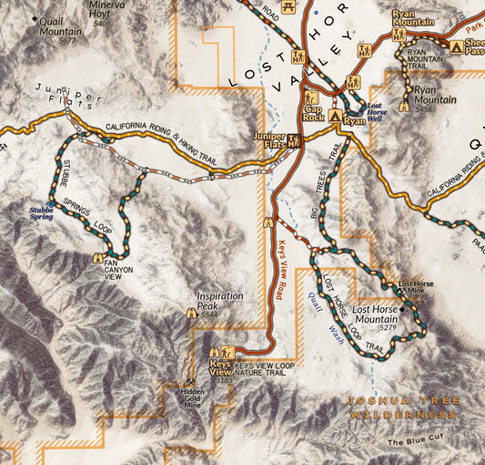
Joshua Tree National Park Visitor Map
Vendor:Avenza MapsRegular price $9.99 USDRegular priceUnit price per -
GoodDog! Dog Park Bend, Oregon
Vendor:Avenza MapsRegular price $0.00 USDRegular priceUnit price per -
Newberry National Volcanic Monument Visitor Map
Vendor:Avenza MapsRegular price $9.99 USDRegular priceUnit price per -
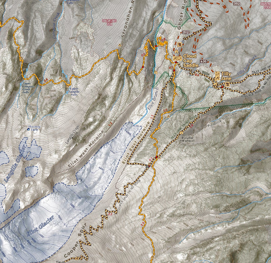
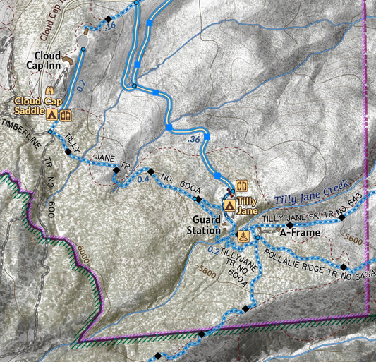
Cloud Cap - Tilly Jane Historic Area - Mount Hood Winter Recreation
Vendor:Avenza MapsRegular price $0.00 USDRegular priceUnit price per -
Paradise Trails and Camp Muir to Summit on Mount Rainier Map
Vendor:Avenza MapsRegular price $4.99 USDRegular priceUnit price per -
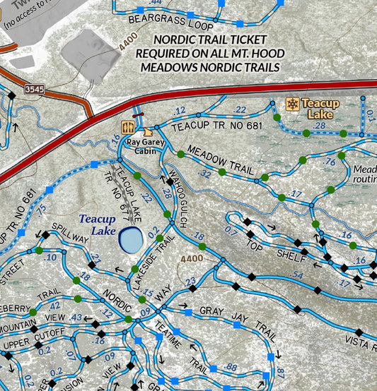
Teacup Nordic And Pocket Creek Winter Map
Vendor:Avenza MapsRegular price $0.00 USDRegular priceUnit price per -
Mount Hood National Forest Winter Recreation Trails and Travel
Vendor:Avenza MapsRegular price $9.99 USDRegular priceUnit price per -
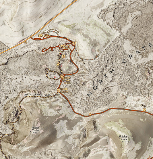
Craters of the Moon National Monument
Vendor:Avenza MapsRegular price $0.00 USDRegular priceUnit price per -
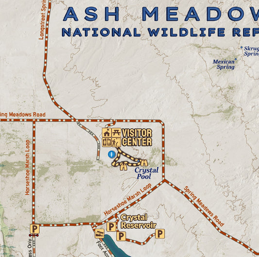
Ash Meadows National Wildlife Refuge - Nevada
Vendor:Avenza MapsRegular price $0.00 USDRegular priceUnit price per -
Pinnacles National Park
Vendor:Avenza MapsRegular price $4.99 USDRegular priceUnit price per


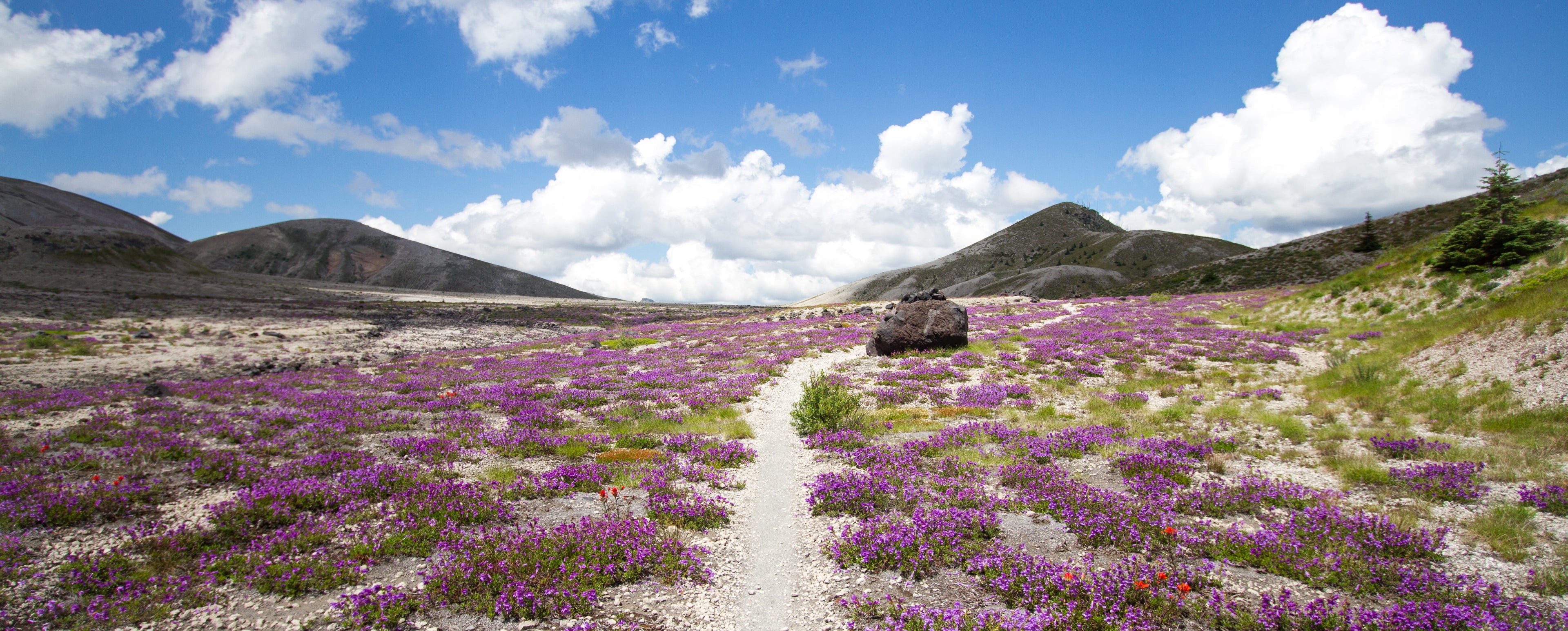
Hiking the Timberline Trail
Interested in Trail Conditions and information about hiking the Timberline Trail around mount Hood?
TIMBERLINE TRAIL!